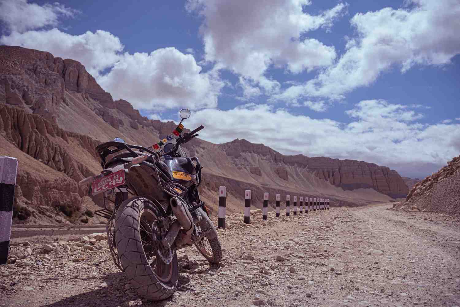
Every rider who comes back from the Himalayas gets asked the same question: where did you go? Most answer with the places everyone already knows. Ladakh. Upper Mustang. The Annapurna Circuit. These are genuinely great routes and deserve their reputations. They are also, increasingly, known well enough that the word "hidden" stopped applying to them some years ago.
The routes in this article are the other ones. The ones that come up in conversations between riders who have done the famous circuits and started asking what comes next. Routes with no Instagram hashtag count worth mentioning, no polished tour operator page with professional photographs, and in several cases no paved road worth the name. Routes where the ratio of riding quality to visitor volume is higher than anything in the standard Himalayan touring canon, and where the combination of technical terrain and cultural depth rewards the preparation required to reach them.
None of these routes are secret. Local communities know them intimately. The riders who have completed them know them. What they share is that they have not yet been absorbed into the mainstream adventure touring circuit, and several of them may not survive that absorption with their character intact. The time to ride them is before that happens.
Tsum Valley, Nepal
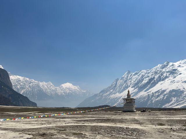
Tsum Valley branches north from the Manaslu Circuit into a restricted Himalayan valley that borders Tibet, and it is the closest thing to a genuinely undiscovered Himalayan motorcycle destination that a foreign rider can legally access. The valley's permit system has kept visitor numbers low enough that the communities along the route have not yet reorganised their lives around tourism in the way that the Annapurna and Mustang circuits have.
The riding itself is among the most technically demanding in Nepal. The track from the Manaslu Circuit junction into the valley combines single-track sections, steep river-side ascents, and crossings that require both confidence and correct technique on loose, wet rock. This is not a route for riders who have only ridden Nepal's main mountain highways. It is a route for riders who have already done something technically demanding in Nepal and want to understand what comes after.
What the riding delivers access to is a Tibetan Buddhist community of extraordinary preservation. The Milarepa caves above Rachen Gompa, where the eleventh-century Tibetan saint is said to have meditated, are accessible on foot from the riding route and represent a pilgrimage site of genuine historical significance that most western travellers have never heard of. The monastery complexes of Mu Gompa and Rachen Gompa are active centres of Tibetan Buddhist practice rather than preserved heritage sites, and the distinction is immediately apparent to any visitor who has experienced both categories.
The valley's agricultural calendar governs its own rhythms independent of any tourism consideration. Riders who arrive during planting or harvest periods find the community occupied with work that has nothing to do with accommodating visitors, and this encounter with a place that has not reorganised itself around your presence is the specific quality that makes Tsum Valley worth the considerable effort required to reach it.
Distance from Kathmandu: Around 200km to the Manaslu Circuit junction, then 60 to 80km into the valley
Permit required: Tsum Valley Restricted Area Permit, Manaslu Conservation Area permit, TIMS Best season: March to May, October to November
Recommended bike: Royal enfield Himalayan, Ktm adventure, Honda CRF300L
Dolpo Circuit, Nepal
_1791040891.jpg)
Dolpo is the largest restricted area in Nepal and the least visited of its major high-altitude regions. The landscape that Peter Matthiessen wrote about in The Snow Leopard in 1978 remains, in most of the ways that matter to a motorcycle rider, recognisably similar to the place he described. Remote, high, cold, and beautiful in the way that places are beautiful when they have not been made beautiful for anyone's benefit.
The motorcycle access to Dolpo comes from two directions. The southern approach via Dunai from Pokhara through Beni is the more established route, covering territory that passes through the mid-hill landscape of the Karnali zone before climbing into the restricted area. The northern approach, from the Mustang district for riders who have permits for both areas, is more demanding and covers terrain that very few foreign riders have completed.
Phoksundo Lake is the destination that defines the Dolpo circuit for most riders who attempt it. A glacial lake at 3,611 metres whose depth and colour produce a quality of blue that photographs approach but do not capture. The approach to the lake from the south requires riding through the Suligad Canyon, a gorge of geological drama that is technically demanding and visually unlike anything else accessible by motorcycle in Nepal.
The permit cost for the Upper Dolpo motorcycle tour is equivalent to Upper Mustang at USD 50/day. Lower Dolpo is less expensive and covers the southern approach through Dunai and Phoksundo Lake. The distinction matters for route planning because Upper Dolpo's most remote sections require a level of self-sufficiency that exceeds anything the Mustang circuit demands, with supply and mechanical support genuinely absent for stretches that make the Kagbeni-to-Lo Manthang track look well-served.
Distance from Pokhara: Around 250 to 300km to Dunai, southern approach
Permit required: Dolpo Restricted Area Permit (USD 50/day for Upper Dolpo, less for Lower), TIMS, Shey Phoksundo National Park permit
Best season: May to June, September to October
Recommended bike: Royal enfield Himalayan, Ktm adventure, Honda CRF300L
Karnali Highway and Humla, Nepal
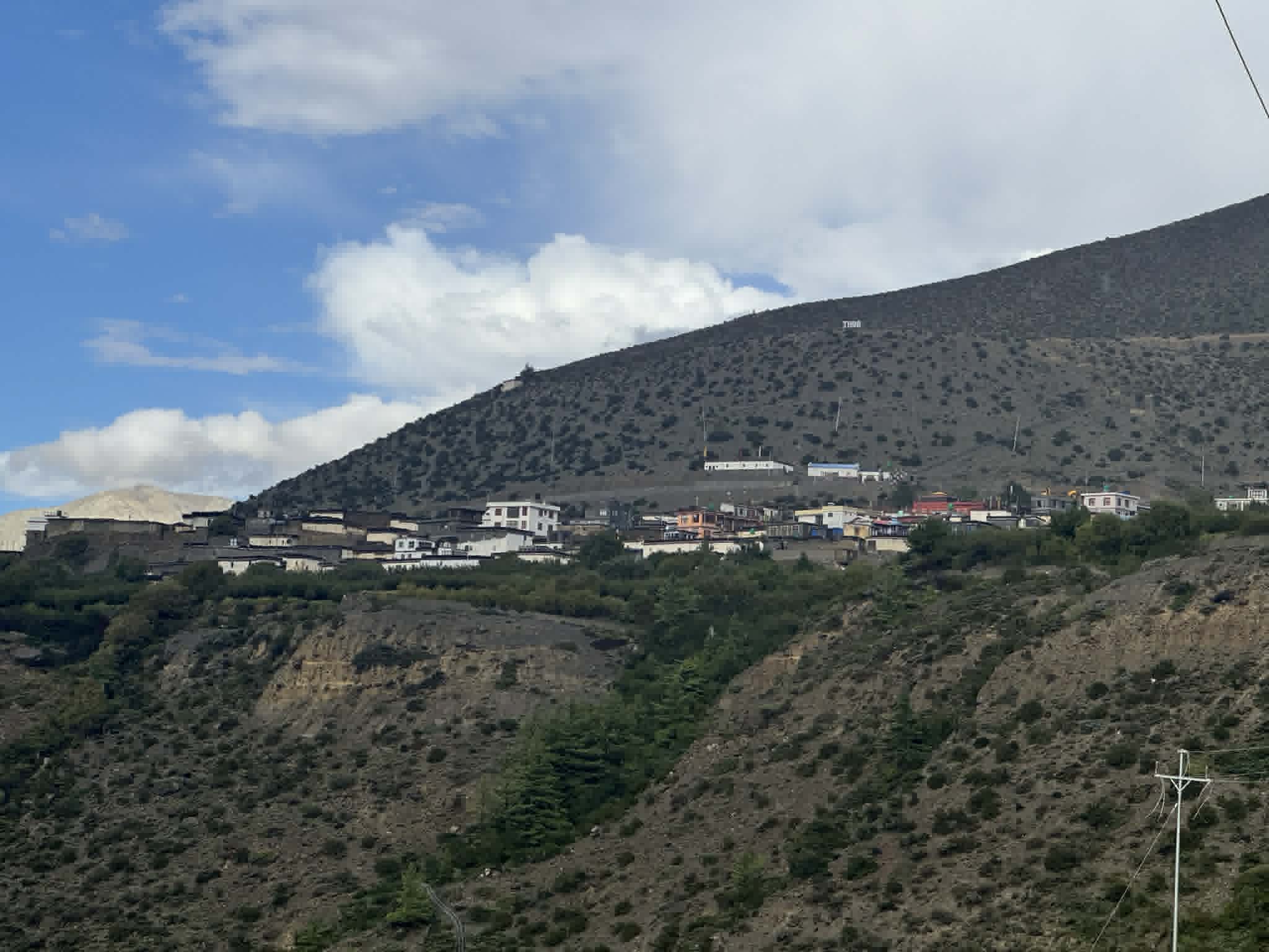
Far western Nepal is the most consistently overlooked region in the country's motorcycle touring landscape, and the reasons for this are logistical rather than related to quality. The distance from Kathmandu, the road conditions on the approach, and the relative scarcity of tour operator knowledge of the region have combined to keep foreign motorcycle visitor numbers low enough that several Humla district communities have never encountered an international motorcycle tourist.
The Karnali Highway, Nepal's most westerly major road corridor, runs through terrain that is geologically and culturally distinct from the Annapurna and Mustang regions that define most international understanding of Nepal's Himalayan landscape. The Karnali River valley has its own dramatic character, deeper and narrower than the Kali Gandaki, with cliff faces of fractured rock in colours that change with the afternoon light in ways that a rider moving through them notices differently from a photographer who has stopped to frame the shot.
Simikot, the district headquarters of Humla at 2,910 metres, is the furthest accessible point for most motorcycle riders attempting the far western Nepal circuit. The route from Surkhet to Simikot via the Karnali Highway is approximately 300 kilometres of road that combines sealed sections, maintained gravel, and passages that require genuine off-road competence on a surface that the map does not always accurately represent. Fuel planning is a serious consideration on this route in a way that even the Mustang approach is not.
The cultural context of Humla is Tibetan Buddhist in the high areas and Hindu in the lower valleys, with a mixing of the two traditions in the mid-zone communities that produces a specific syncretic religious culture found nowhere else in Nepal with the same character. The Limi Valley, branching from the main Humla route toward Tibet, is accessible with additional restricted permits and is the kind of destination that riders who have done everything else in Nepal start researching quietly.
Distance from Kathmandu: Around 550km to Surkhet, main gateway to the western region
Permit required: Humla Restricted Area Permit for upper sections, TIMS
Best season: April to June, September to October
Recommended bike: Royal enfield Himalayan, Ktm adventure, Honda CRF300L
Zanskar Valley, India
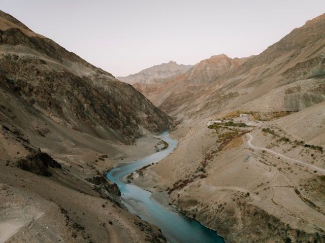
Zanskar is Ladakh's more remote and less-visited neighbour, a high-altitude valley in Jammu and Kashmir that was accessible only via a seasonal mountain pass until the Zanskar road was extended in recent years. The road's relatively recent completion means that the infrastructure along it is still developing, and the community settlements it connects have not yet been shaped by sustained tourism in the way that Leh and the main Ladakh circuit have.
The approach from Kargil via the Suru Valley and Pensi La pass at 4,401 metres is the standard motorcycle entry to Zanskar. The descent from Pensi La into the Zanskar valley is among the most dramatic road descents available in India, with the valley floor visible far below and the Drang-Drung glacier occupying the adjacent mountainside in a scale that recalibrates what the word glacier means to anyone who has only seen photographs.
Padum, the main settlement of Zanskar at 3,657 metres, is a functional small town that has not yet been reshaped into a tourism hub. The guesthouses are basic, the food is simple, and the community's daily life proceeds with an indifference to the visitor's schedule that experienced Himalayan riders find refreshing rather than inconvenient.
The route from Padum toward the Shingo La pass, which crosses into Himachal Pradesh and connects Zanskar with the Lahaul and Spiti road network, is a technical track that is passable on capable dual-sport machines in July and August and closed by snow for the rest of the year. Riders who time the crossing correctly complete a loop that connects two of India's most compelling restricted regions without retracing the same road, which is the kind of route that takes a full season of planning to execute correctly and produces the kind of riding that riders describe for years afterward.
Distance from Leh: Around 240km to Padum via Kargil
Permit required: Inner Line Permit for Zanskar
Best season: July to September
Recommended bike: Royal Enfield Himalayan 411 or 450, Hero Xpulse 200/210
Pin Valley, India
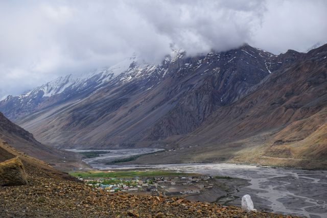
The Pin Valley in Himachal Pradesh is the Spiti Circuit's least-known branch and one of the most technically demanding day routes accessible from the main Spiti road network. The Pin River valley branches south from the Spiti Highway near Attargo, climbing through a landscape of barren high-altitude terrain that the Spiti Valley's reputation for dramatic scenery does not fully prepare a rider for.
The road into Pin Valley transitions from maintained track to unmaintained single-track within a few kilometres of the junction, and the upper sections require off-road technique and a light machine. The Royal Enfield Himalayan is at the upper end of what the most technical sections accommodate comfortably. The Hero Xpulse and Honda CRF series machines handle it with more margin.
Pin Valley's cultural context is the Pin-Parvati Pass corridor, connecting the Buddhist Spiti Valley with the Hindu Kullu Valley on the southern side of the range. The pass itself is a trekking route rather than a motorcycle route, but the valley's position at this cultural junction produces communities with a mixed heritage that differs from the more uniformly Buddhist character of the main Spiti valley settlements.
The Kungri Monastery in Pin Valley, one of the oldest Nyingmapa Buddhist monasteries in the Spiti region, is accessible from the riding route and warrants more time than most riders give it. The monastery's annual Chakhar festival, held in July, draws communities from across the region and is the kind of event that a rider who happens to be there on the right day remembers as one of the trip's defining encounters.
Distance from Kaza: Around 25 to 30km to the main valley settlements
Permit required: Inner Line Permit for Spiti
Best season: June to September
Recommended bike: Hero Xpulse 200/210, Honda CRF300L
Sela Pass and Tawang, Arunachal Pradesh, India
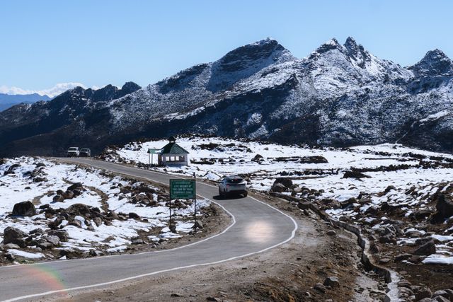
Tawang is the most easterly destination on this list and the one that most Indian and international motorcycle tourists have not considered as a Himalayan riding destination. Arunachal Pradesh's permit requirements for foreign nationals, combined with its distance from the main Himalayan motorcycle touring circuits of Ladakh and Himachal Pradesh, have kept it well outside the standard adventure touring conversation.
The approach to Tawang from Tezpur in Assam via the Sela Pass at 4,170 metres is a two-day motorcycle journey through a landscape that transitions from the tropical forests of Assam's foothills through alpine terrain and across a pass that carries snow even in summer years. The Sela Pass is one of the highest motorable passes in Arunachal Pradesh and delivers the combination of altitude, exposure, and mountain scenery that riders travel to Ladakh to find, in a setting where the road carries a fraction of the traffic.
Tawang Monastery, the largest monastery in India and the second largest in Asia after Lhasa's Potala Palace, is the destination that justifies the journey independently of the riding. Founded in 1681 CE at an elevation of 3,048 metres, it houses around 450 monks and a collection of sacred texts and artifacts of historical importance. The monastery's position above the town, with the valley below and snow peaks behind, is among the most compelling visual contexts of any Himalayan religious site accessible by motorcycle.
The political sensitivity of Arunachal Pradesh's proximity to the China border means that foreign national permits, while obtainable, require advance planning through registered operators and are occasionally subject to restrictions that domestic Indian riders do not face. Indian riders, by contrast, find Tawang one of the most rewarding and relatively accessible of the less-visited Himalayan destinations.
Distance from Tezpur: Around 320km to Tawang
Permit required: Protected Area Permit for foreign nationals; Inner Line Permit for Indian nationals
Best season: April to June, September to October
Recommended bike: Royal Enfield Himalayan 411 or 450
Nar Phu Valley, Nepal
The Nar Phu Valley is a restricted extension of the Annapurna Circuit that branches north from Koto, a village on the main circuit route, into a pair of valleys that were closed to foreigners until 2003 and that remain, due to a high permit cost and limited awareness, among the least-visited restricted areas in Nepal.
The villages of Nar and Phu sit at elevations above 4,000 metres in a landscape that is more Tibetan plateau than Himalayan valley, sharing the high-altitude desert character of Upper Mustang but with a different geological character. The rock formations in the upper Phu valley, eroded into columns and canyon systems that make the approach feel more like riding through a river-carved desert than through the Himalayas, are unlike anything else accessible by motorcycle in Nepal.
The permit cost for Nar Phu is significant enough to discourage casual visitors: around USD 90 per person per week. This cost has, however, preserved the valley's cultural character in ways that lower-cost restricted areas have not always managed. The communities of Nar and Phu maintain traditional agricultural and pastoral practices, with stone houses, carved wooden window frames, and a social organisation that the trekking tourism of the main Annapurna Circuit has not reached.
The motorcycle access to Nar Phu is limited by the track condition. A capable dual-sport machine can reach the lower valley settlements. The upper villages require either on-foot access from a lower riding point or a very capable machine with a rider willing to accept significant technical risk on a track that is genuinely unmaintained.
Distance from Besisahar: Around 60 to 80km to Koto junction on the Annapurna Circuit
Permit required: Nar Phu Restricted Area Permit (around USD 90 per week), Annapurna Conservation Area permit, TIMS
Best season: March to May, October to November
Recommended bike: Hero Xpulse 200/210, Honda CRF300L
Gya-Miru Loop, Ladakh, India
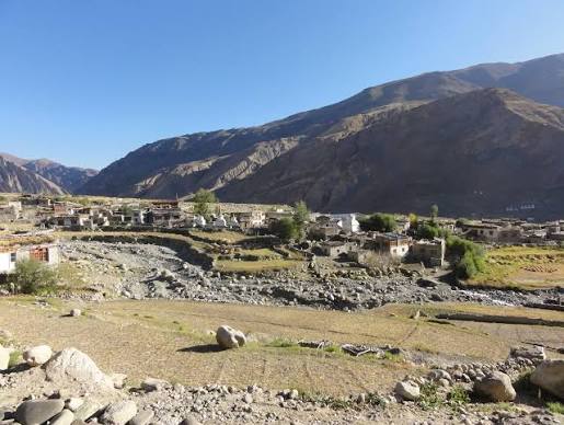
Most Ladakh riders follow one of three main circuits: the Manali-Leh approach, the Nubra Valley via Khardung La, or the Pangong Lake route via Chang La. The Gya-Miru loop east of Leh is a day or overnight route that sits between these main circuits and is known primarily to riders based in Leh who have run out of new roads to explore on the standard itineraries.
The loop climbs from the Indus Valley through the Gya and Miru villages, crossing passes that reach above 5,000 metres on certain variations of the route, through a landscape of high-altitude desert that the main Ladakh circuits access at lower elevations. The road surface on most of the loop is unmaintained track rather than the Border Roads Organisation-maintained passes that the famous Ladakh routes follow, and the distinction in surface character is considerable.
The human context of the Gya-Miru loop is its most underappreciated quality. The villages it passes through are not on any trekking route and do not receive the visitor volumes that the main circuit villages accommodate. Community members in Gya and Miru have not developed the transactional relationship with tourism that Leh's old town, Nubra's guesthouses, and Pangong's lakeside camps have acquired over two decades of heavy visitor traffic. The interaction quality that results is different in a way that riders who have been to Leh multiple times consistently describe as worth the additional planning.
Distance from Leh: Around 60 to 80km depending on route variation
Permit required: Inner Line Permit for certain sections
Best season: June to September
Recommended bike: Royal Enfield Himalayan 411, Hero Xpulse 200/210
Planning These Routes: What Is Different From the Standard Himalayan Circuits
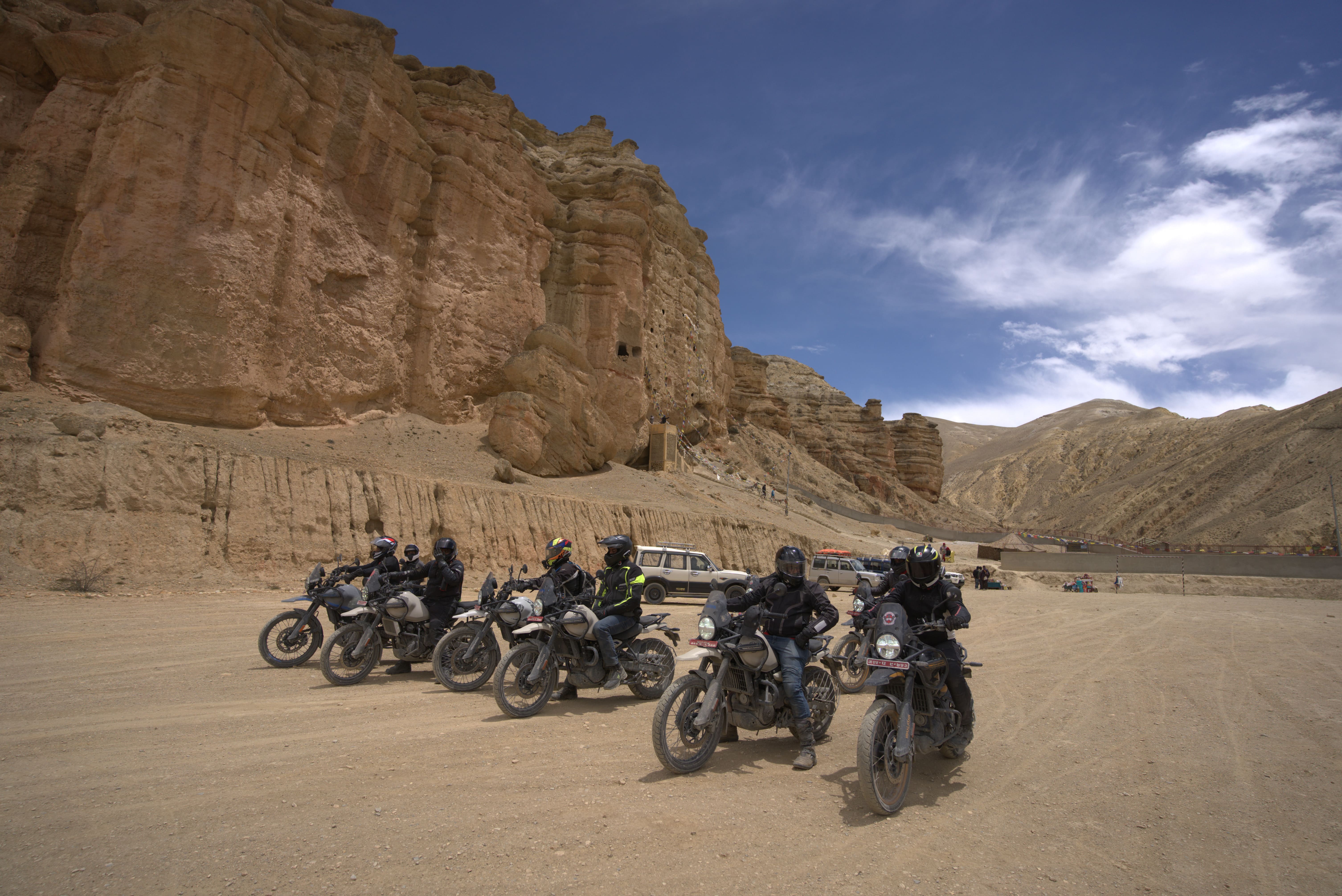
The routes above share several practical characteristics that separate them from the standard Himalayan touring canon and require a different approach to planning.
Permit processing timelines are less predictable than for the more established restricted areas. Upper Mustang permits are processed routinely and quickly by experienced Nepal operators. Nar Phu permits, Dolpo permits, and Humla permits are processed by the same system but less frequently, and operators with less experience of these specific areas can underestimate processing time or documentation requirements. Using an operator who has specifically processed the permit you need, rather than one who processes Upper Mustang permits and assumes the system works the same way for everything, makes a real difference to departure date reliability.
Fuel planning on these routes requires calculations that the Mustang approach does not. The gap between reliable fuel stops on the Dolpo southern approach and the Karnali Highway exceeds anything on the main Himalayan circuits, and carrying supplementary fuel is not a precaution but a planning requirement on several of these routes. A fuel calculation based on your specific bike's mountain consumption, with a meaningful reserve margin, is part of the preparation rather than something to improvise on the road.
Mechanical self-sufficiency requirements are higher than on routes where a Royal Enfield mechanic exists in every third town. Riders attempting Tsum Valley, Upper Dolpo, or Humla should be able to handle a wider range of mechanical issues independently than the Mustang circuit demands, and the toolkit and spare parts selection that a well-prepared rider carries on these routes is more comprehensive than what the standard Himalayan packing list recommends.
Accommodation booking logic is different. On the Mustang circuit, guesthouses exist at the right intervals and fill in a predictable pattern that experienced operators know. On the routes in this article, accommodation intervals are wider, options at each point are fewer, and the risk of arriving somewhere with no available room is higher. Riding later into the day than planned, for whatever reason, has more serious consequences on a route with limited overnight options than on a route where the next village is always within range.
None of this is a reason to avoid these routes. It is a reason to plan them with more care than the standard circuits require, and to approach them with the honest self-assessment about skill and self-sufficiency that makes the difference between a challenging ride and a dangerous one.
Who These Routes Are Actually For
The routes in this article are for riders who have done the standard Himalayan circuits, found them rewarding, and are asking what the next level looks like. They are not for beginners to Himalayan riding, not because the Himalayas should be gatekept, but because the consequences of skill and preparation gaps are genuinely more serious on routes with thinner support infrastructure and fewer passing vehicles to provide assistance.
A rider who has completed Upper Mustang ride independently, who has managed the mechanical and navigational decisions that route demands, and who came away wanting more technical terrain, more cultural depth, and fewer other riders on the same road, is the rider these routes were written for.
The preparation is more demanding. The logistics are more complex. The roads are harder. The mechanic is further away. And the experience of riding through terrain that the standard Himalayan touring circuit has not yet absorbed produces exactly the quality of encounter that most adventure riders are ultimately looking for when they describe what they want from the next trip, even if they have not yet found the words for it.