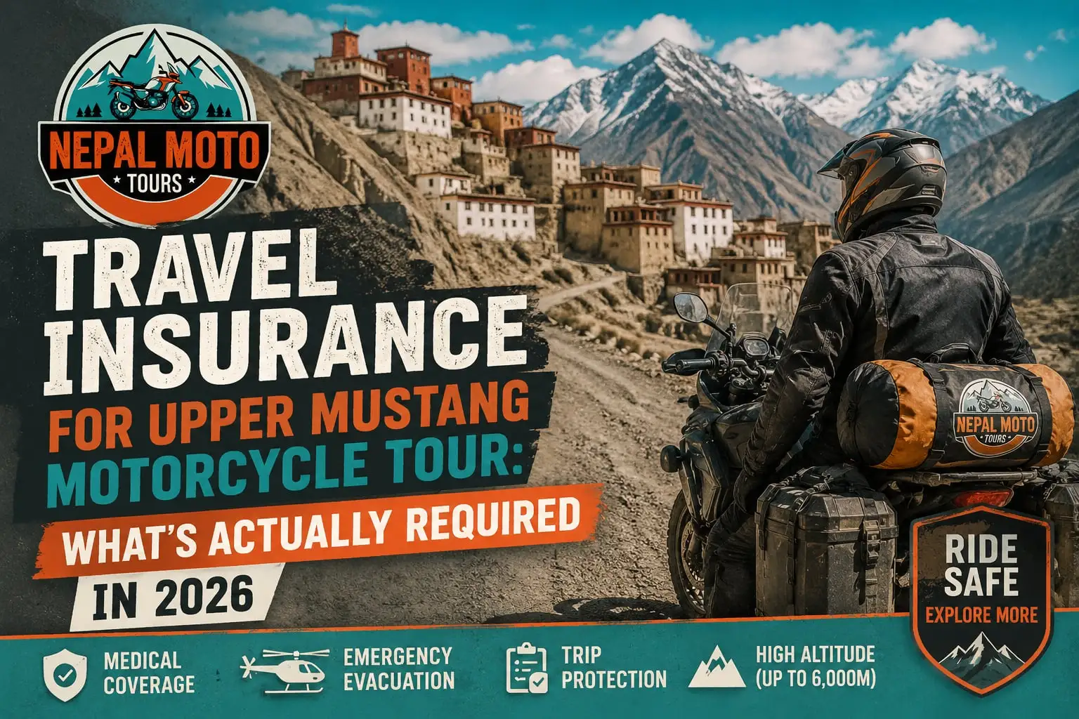
Most travel content about Nepal shows the same things: mountain panoramas, ancient monasteries, scenic switchbacks, highlight reels set to cinematic music. None of that is false. But it is incomplete. The motorcycle nomad experience in Nepal is something structurally different, a daily rhythm that weaves remote work, Himalayan riding, physical recovery, and slow cultural immersion into a single coherent lifestyle. This is more of a slow ride rather than a typical motorcycle tour in Nepal. This guide takes you inside a real motorcycle nomad day in Nepal, hour by hour, with honest notes on what works, what surprises people, and why Nepal specifically, rather than Bali, Chiang Mai, or Lisbon, has become the most compelling remote work and riding destination in Asia.
Table of Contents
Why Nepal Is Built for the Motorcycle Nomad Life
The Morning: Waking Up Inside a Landscape
7:00 AM: The Slow Start Ritual
8:00 AM: The Deep Work Block
Where to Work: Connectivity by Location
11:30 AM : The Transition Phase
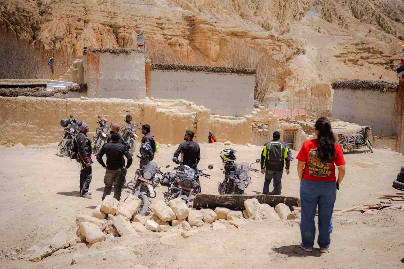
12:00 PM : Riding Begins
What the Riding Actually Feels Like by Region
1:30 PM : Scenic Stop and Lunch
3:00 PM : Afternoon Ride or Light Exploration
5:00 PM : Return and Recovery
6:30 PM : Evening Work and Content Window
7:30 PM : The Sunset Moment
8:00 PM : Dinner and Social Time
9:30 PM : Wind Down and Preparation
Day Variations: Work-Heavy, Ride-Heavy, Expedition
Nepal vs. Other Digital Nomad Destinations
The Inner Shift: What This Lifestyle Does to You
Frequently Asked Questions
1. Why Nepal Is Built for the Motorcycle Nomad Life
The digital nomad movement has been running long enough to produce a settled hierarchy of destinations. Bali, Chiang Mai, Lisbon, Medellín, Tbilisi, these cities have functional coworking infrastructure, established expat communities, and enough English-speaking services to make settling relatively frictionless. Nepal is not on that list. And that is precisely what makes it interesting.
Nepal offers something different from every established nomad hub, and the difference is geographic. Within a single day's ride from Kathmandu or Pokhara, you can transition from subtropical river valley at 800 metres through terraced agricultural hillside at 1,500 metres into rhododendron forest at 2,500 metres and, if you push further, into high-altitude desert terrain above 3,500 metres. No other nomad destination on earth puts this kind of environmental range within a day's riding of a café with 100 Mbps internet.
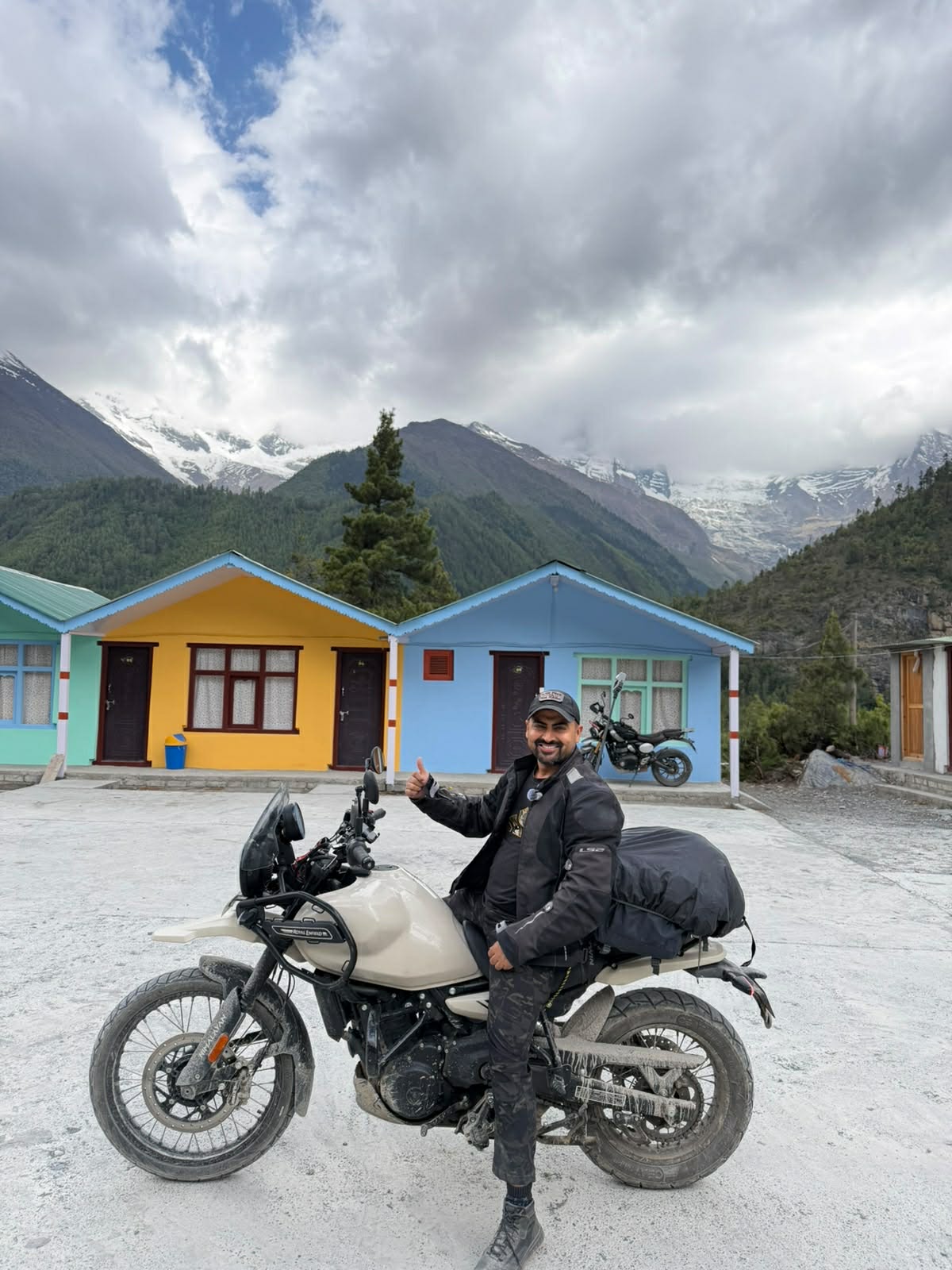
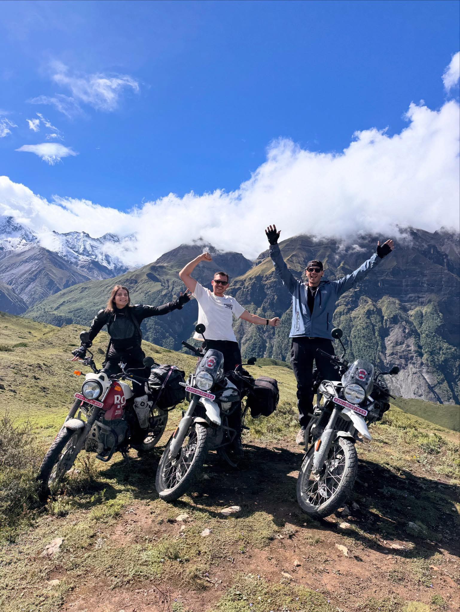
The motorcycle is what unlocks it. On foot, covering this terrain takes weeks. By jeep, you are a passenger. On a motorcycle, specifically a Royal Enfield Himalayan or Honda CRF, the two most practical choices for Nepal's road mix, you are the mechanism of your own movement. You feel the temperature drop as you gain elevation. You smell the transition from pine forest to dust. You slow down at river crossings and make judgements that matter. The experience is embodied in a way that no other form of Nepal travel produces.
Add the work layer, the remote income that allows sustained presence rather than a holiday — and the lifestyle becomes something genuinely new. Not a vacation. Not an office. Something between, with the best qualities of both and the compromises of neither.
2. The Morning: Waking Up Inside a Landscape
6:30 AM
The first thing most motorcycle nomads in Nepal notice, particularly after arriving from urban nomad hubs, is how waking up feels different here.
In Kathmandu, even in the heart of Thamel, mornings start with something quieter than you expect from a city of this density. Before the traffic builds, there is birdsong, the distant sound of temple bells, and occasionally the low thrum of a monk's prayer from a nearby monastery. By 6:30 the light is already moving across the hills on the northern rim of the valley.
In Pokhara, waking up facing Phewa Lake on a clear morning is one of the more arresting experiences available to someone who has just opened their eyes. The Annapurna range hangs in the pre-mist air, Machapuchhre (the Fishtail peak) visible with unusual sharpness at this hour before afternoon cloud builds. The lake surface is still. The effect is not subtle.
On the Mustang route, from Jomsom northward mornings are something else entirely. The thin air at 2,700 metres has a physical quality that wakes you completely and immediately. The light in the upper valley is extraordinarily clear, with none of the haze that characterises lower-altitude mornings. Wind starts to build around 9 or 10 am, which shapes the riding schedule more than any other single variable. But at 6:30, the desert plateau is completely still.
This geographic variety in the morning experience is not incidental to the motorcycle nomad lifestyle, it is central to it. The fact that where you wake up physically changes how waking up feels creates a quality of daily renewal that long-term nomads in fixed locations, even beautiful ones — eventually lose. Nepal renews it continuously by moving you through genuinely different environments every few days.
3. 7:00 AM — The Slow Start Ritual
One of the more consistent behavioural patterns among experienced motorcycle nomads in Nepal is the deliberate refusal to rush the morning. This is not laziness. It is an adaptation.
Nepal's mountain roads are safest in the morning hours, specifically before 1 pm when afternoon winds in the Kali Gandaki valley can make riding genuinely difficult, and before afternoon cloud builds in the lower-altitude sections to reduce visibility. This creates a natural incentive structure that rewards morning productivity at a desk and riding in the pre-noon window.
The slow morning typically looks like this:
Black coffee or tea comes first. In Kathmandu and Pokhara, the café culture is good enough that this involves a proper espresso and a view worth looking at for ten minutes without immediately opening a laptop. In teahouse accommodation on the trail routes, butter tea (thick, salty, warming) or milk tea with ginger serves the same settling-in function.
Breakfast in Nepal is not elaborate. Dal bhat leftovers reheated from the night before, eggs in various configurations, porridge with honey, or simple toast is the standard. Mountain appetite operates differently from sea-level appetite, the combination of altitude and physical activity creates a specific hunger pattern that tends toward carbohydrates and warmth rather than the protein-heavy breakfasts that gym culture has made standard in the west.
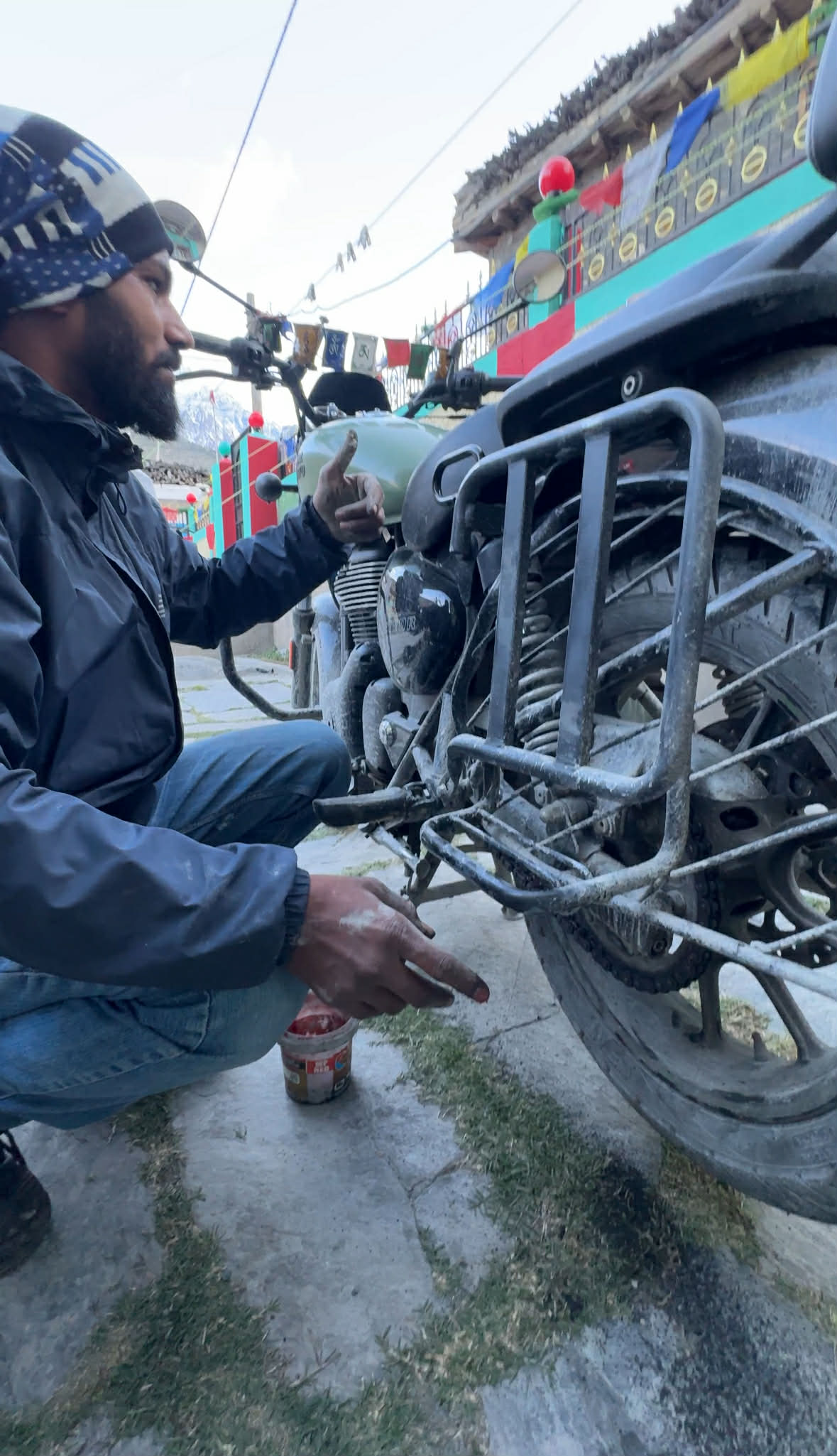
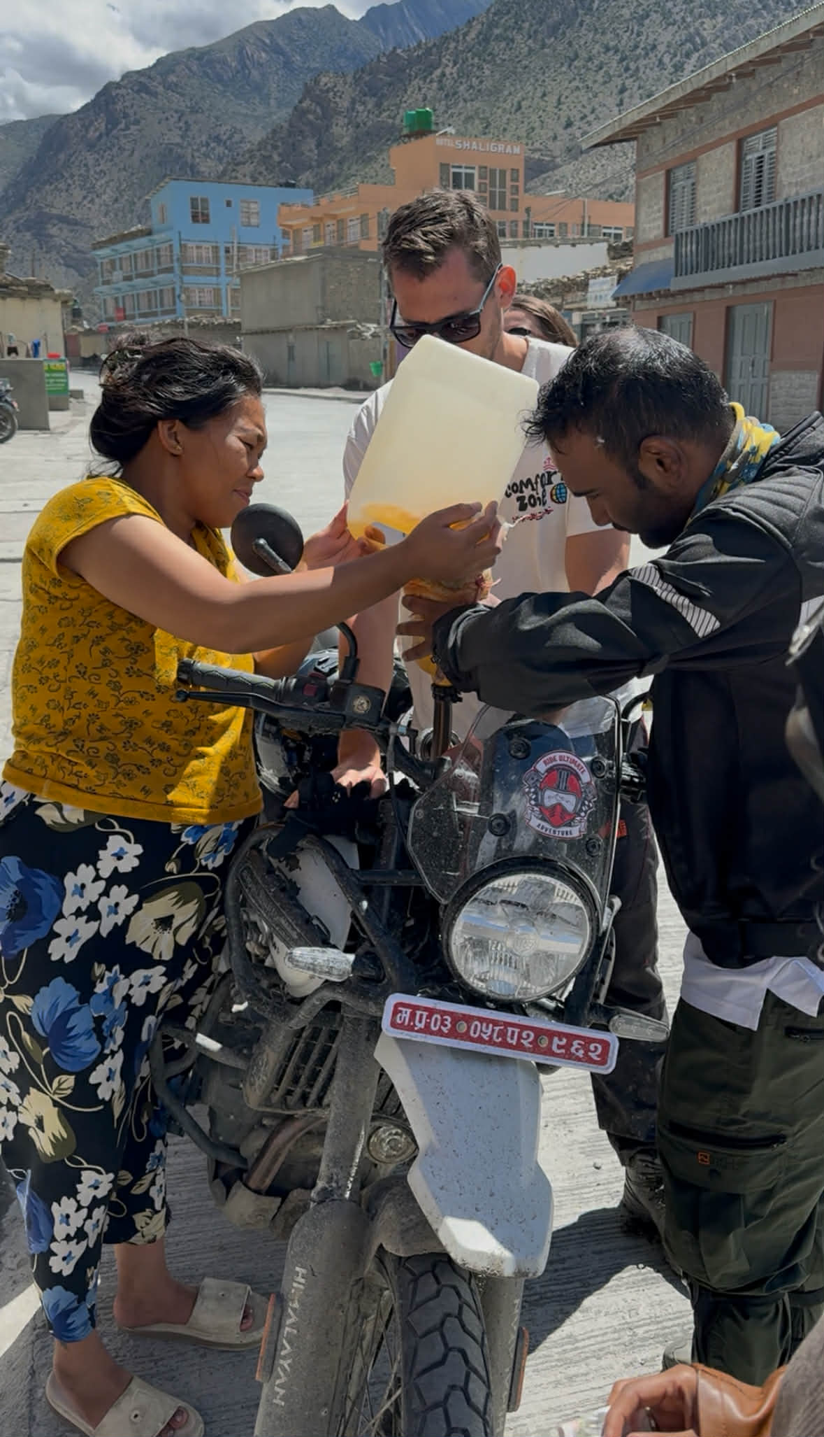
While eating, two checks happen that structure the rest of the day. The first is weather — specifically cloud pattern, wind direction, and whether any precipitation is likely in the afternoon. In Nepal, these checks are not casual. Weather determines routing, timing, and in some cases whether to ride at all. The second is the bike, a walk-around that confirms tyre pressure, chain tension, fuel level, and brake feel. Experienced riders in Nepal do this automatically. New arrivals learn to do it quickly after their first puncture ten kilometres from the nearest help.
By 7:45, the morning has been absorbed. The laptop opens.
4. 8:00 AM — The Deep Work Block
This is the most important two to four hours of the motorcycle nomad's Nepal day, and the window most people get wrong before they get it right.
The temptation on arrival in a place as visually overwhelming as Nepal is to compress or eliminate the work block entirely and fill the time with experience. This works for two or three days. It does not work for a 30-day program. The structure that makes the motorcycle nomad lifestyle sustainable over a month is the clear separation of work time and riding time — and the discipline to protect both.
The 8:00 to 11:30 am window is the productive period. The principles that apply are familiar to any experienced remote worker, deep focus on the highest-priority task first, async communication batched into a single window rather than managed reactively throughout the day, and minimal meetings unless they are genuinely synchronous by necessity.
What changes in Nepal is the quality of the focus. This is the element that people reliably report as surprising, regardless of whether they expected it or not.
The combination of physical tiredness from riding (even experienced riders find Nepal's terrain more fatiguing than standard roads), altitude effect on the nervous system at mid-elevations, and the complete absence of the urban stimulation that usually competes for attention — notifications, street noise, social media ambient pressure, creates a cognitive environment that many remote workers describe as the most focused they have experienced in years. There are no colleagues visible through a partition. There is no commuter traffic through the window. There is a mountain, a cup of coffee, a deadline, and a quiet room.
Work expands into this space naturally.
5. Where to Work: Connectivity by Location
Connectivity is the practical variable that motorcycle nomads research most carefully before committing to Nepal, and the picture is more nuanced than either the optimistic "Nepal has 4G everywhere" claims or the pessimistic "the internet disappears after Pokhara" warnings suggest.
Kathmandu
Kathmandu's connectivity in 2026 is genuinely functional for serious remote work. Coworking spaces in Thamel, Lazimpat, and the Boudha area offer stable connections in the 50–200 Mbps range, power backup for load-shedding periods, and enough of a community of resident remote workers to make the environment socially coherent. Popular coworking options include spaces along Thamel's main circuit and the cluster of newer purpose-built spaces that have opened near the Boudha stupa.
Café WiFi is more variable, the better cafés in Thamel and Jhamsikhel are reliable for the work session, while the atmospheric but budget spots may deliver inconsistent speeds. The backup is a local SIM card with data: NTC and Ncell both offer 4G in Kathmandu and are the most cost-effective mobile data in South Asia at current rates. Most experienced nomads carry both.
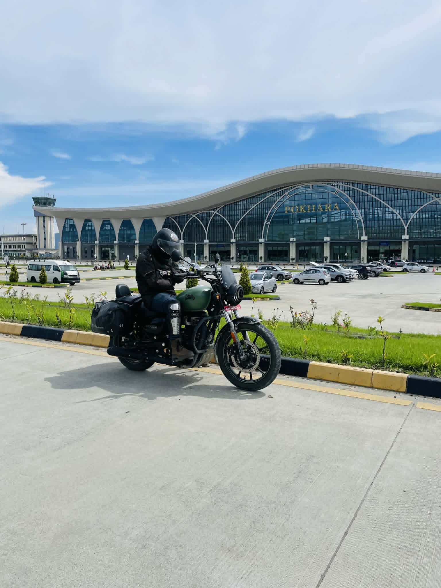
Pokhara
Pokhara's Lakeside district has developed genuinely solid remote work infrastructure over the past few years, driven by the growing resident nomad population that winters there. Café connectivity along the lake perimeter runs at 20–50 Mbps typically, which handles standard remote work — video calls, cloud storage, async communication — without difficulty. The coworking options are fewer than Kathmandu but expanding. The creative quality of the environment, working with the Annapurna range visible through the café window on a clear morning, is something that productivity researchers would probably classify as a significant environmental advantage.
On the Trail Routes
Beyond Pokhara, internet connectivity becomes the variable that requires advance planning rather than assumption. In Jomsom, NTC provides a usable signal that handles messaging and email but degrades quickly under video call load. In the villages between Jomsom and Kagbeni, signal exists intermittently. Beyond Kagbeni into Upper Mustang, mobile connectivity is largely absent.
This absence is, for most motorcycle nomads who have experienced it, not the problem it sounds. The work block happens in the morning at the previous night's accommodation — typically the best connectivity point on any given day. The riding fills the rest. The evenings are light editing and email, not deep work. The system accommodates the connectivity reality rather than fighting it.
A satellite communicator (Garmin inReach or equivalent) is strongly recommended for the Upper Mustang and other remote sections — not for internet access but for emergency communication and location sharing with your contacts at home.
6. 11:30 AM — The Transition Phase
This is the moment in the day that people who have not experienced the motorcycle nomad lifestyle find hardest to imagine, and that people who have lived it identify as its most psychologically distinctive feature.
At 11:30, the laptop closes. The work is done for the morning. What happens next is not a break, it is a complete context switch. The gear comes out. The helmet is checked. The bike is prepped. Within fifteen minutes, the person who was a few minutes ago writing code or editing copy or running a client call is now standing in mountain air, adjusting riding gloves, looking at a road that climbs into a landscape that is frankly not possible to contextualise with any office reference.
The mental shift this produces is not something you need to manufacture or prepare for. It happens automatically and completely. The riding environment demands full present-tense attention — road surface, wind, other vehicles, altitude, navigation — in a way that leaves no cognitive bandwidth for whatever was occupying the work block. The digital world does not follow you out of the café. The mountain begins immediately.
Experienced motorcycle nomads describe this transition as one of the most reliably effective mental resets they have found across years of location-independent work. The physical demand of the riding is sufficient to clear the work residue in a way that a lunch break walk or an afternoon gym session does not.
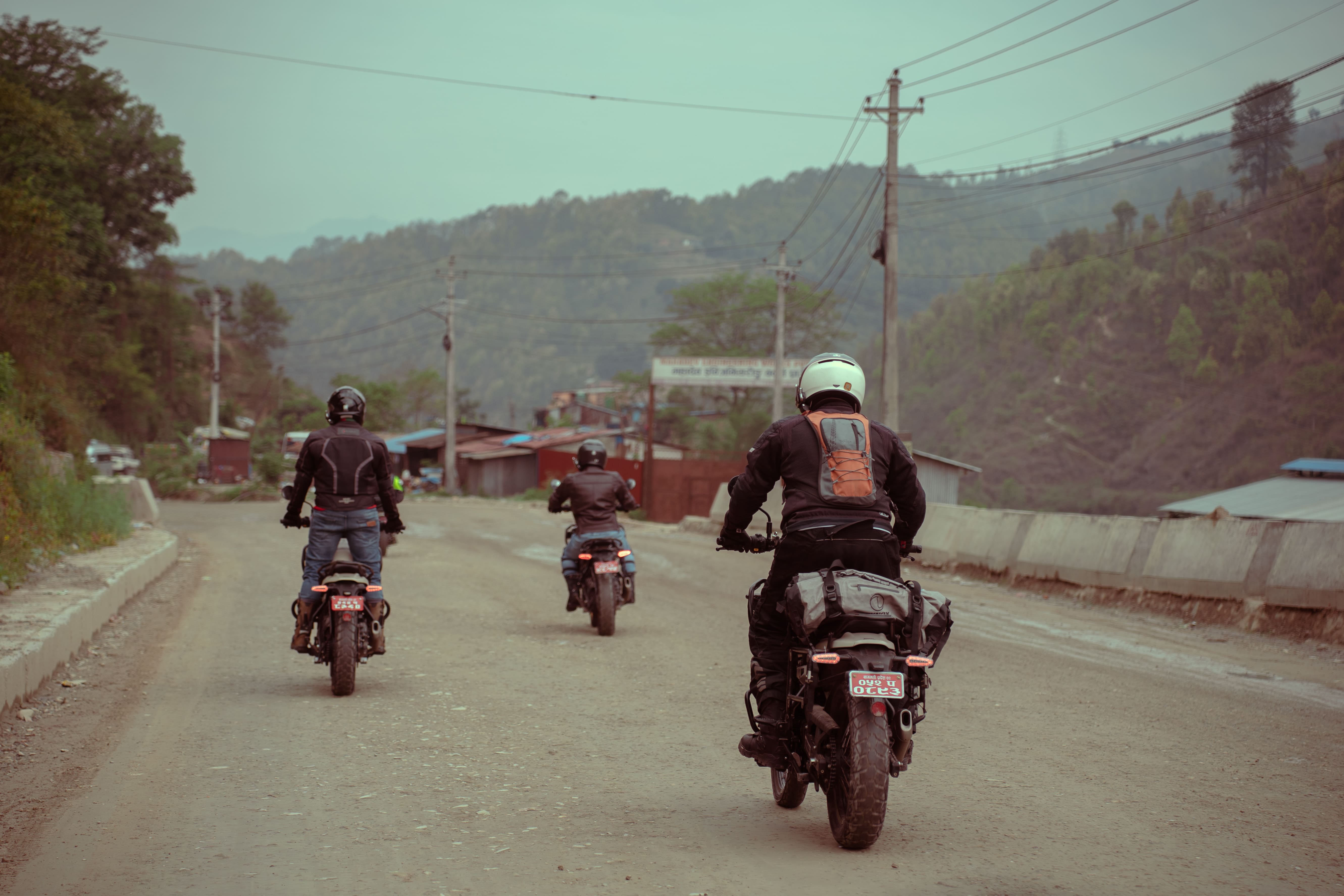
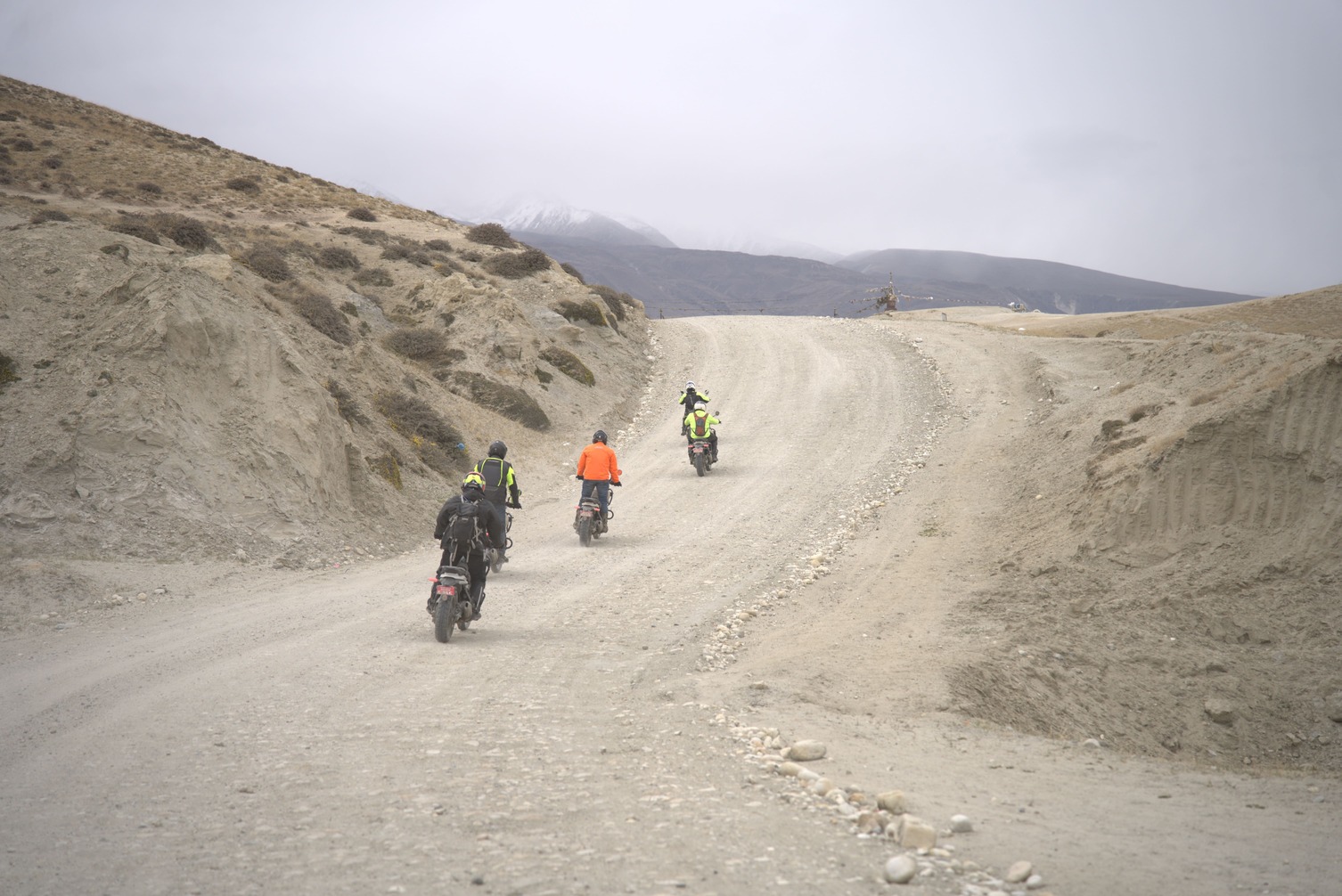
7. 12:00 PM — Riding Begins
The riding phase of the day is when Nepal's claim to uniqueness in the motorcycle nomad world becomes inarguable.
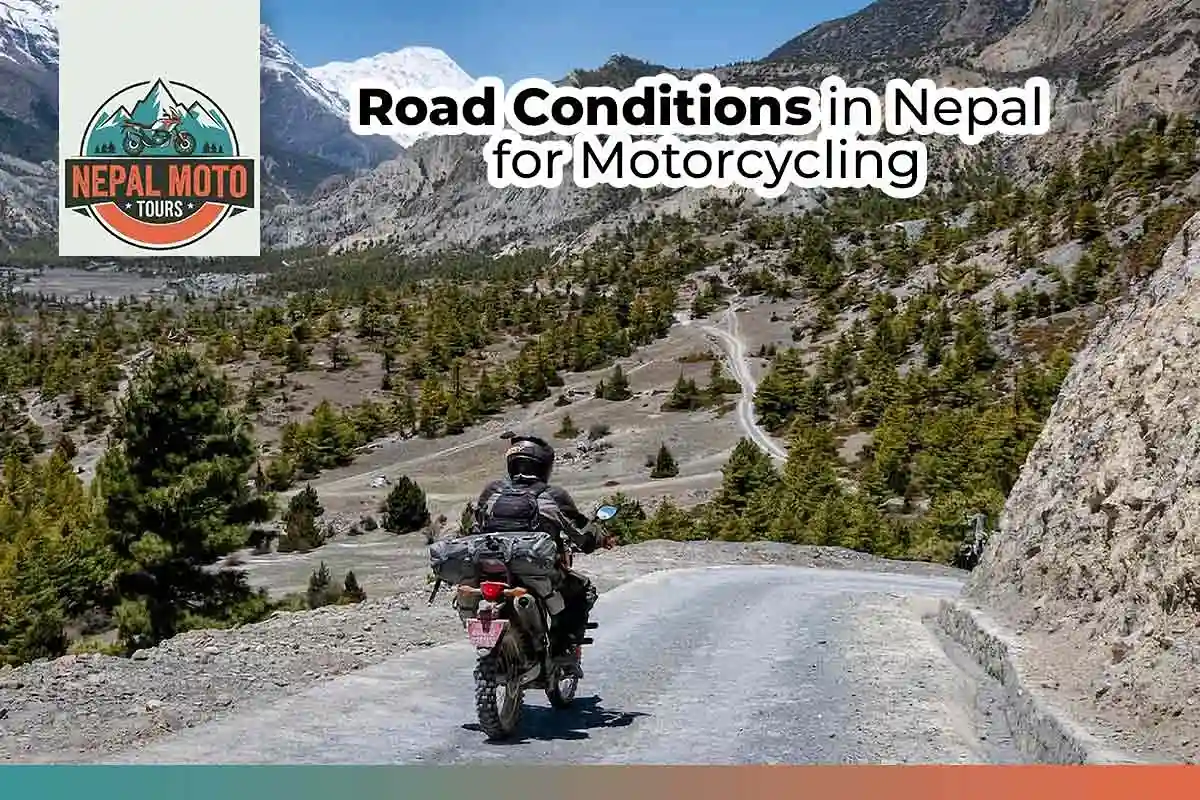
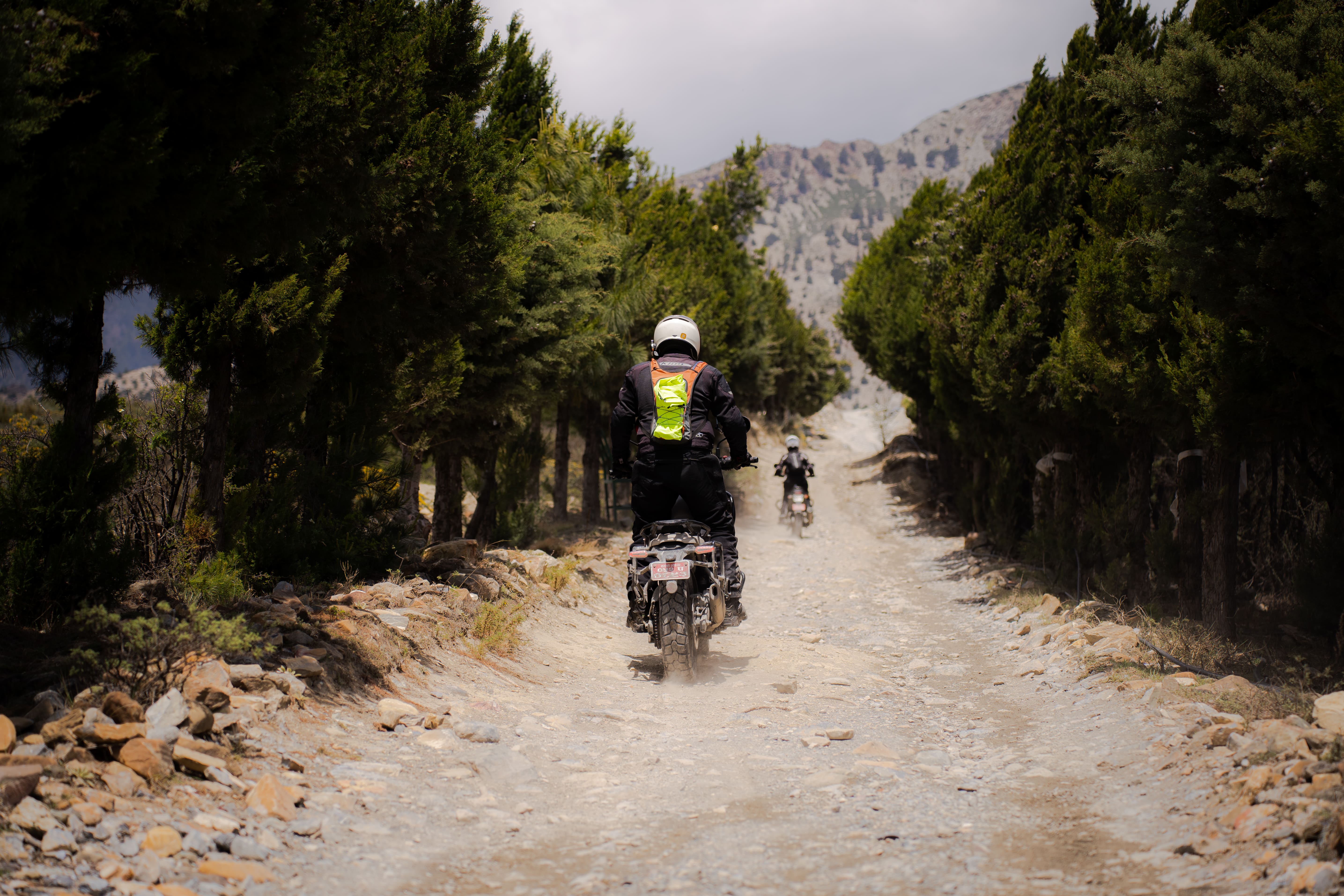
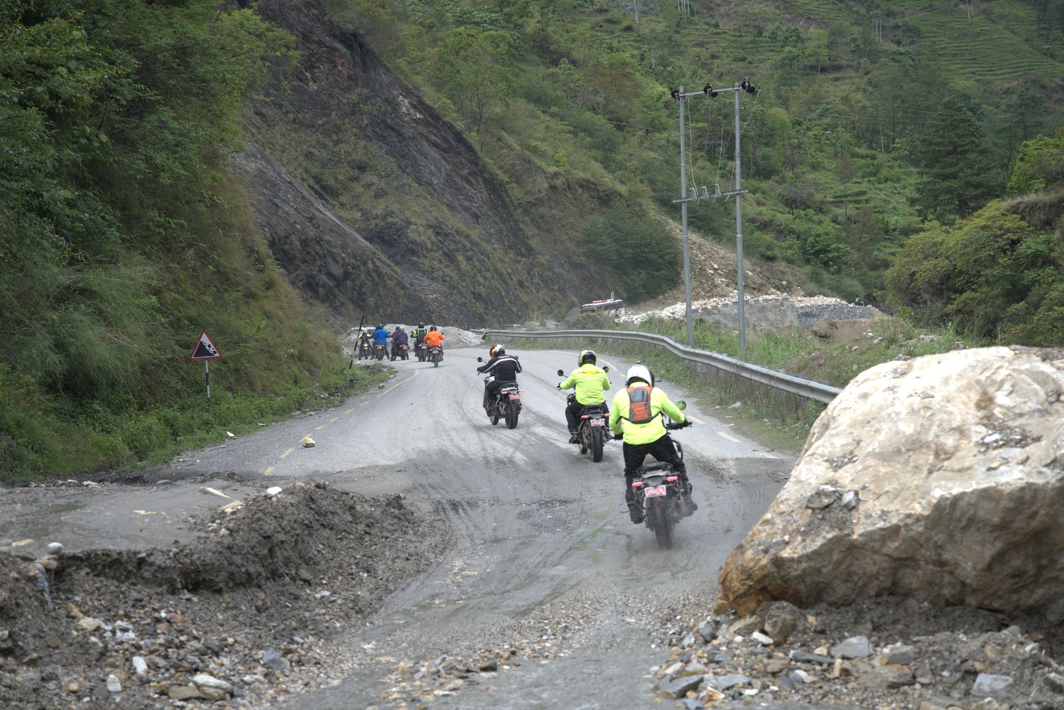
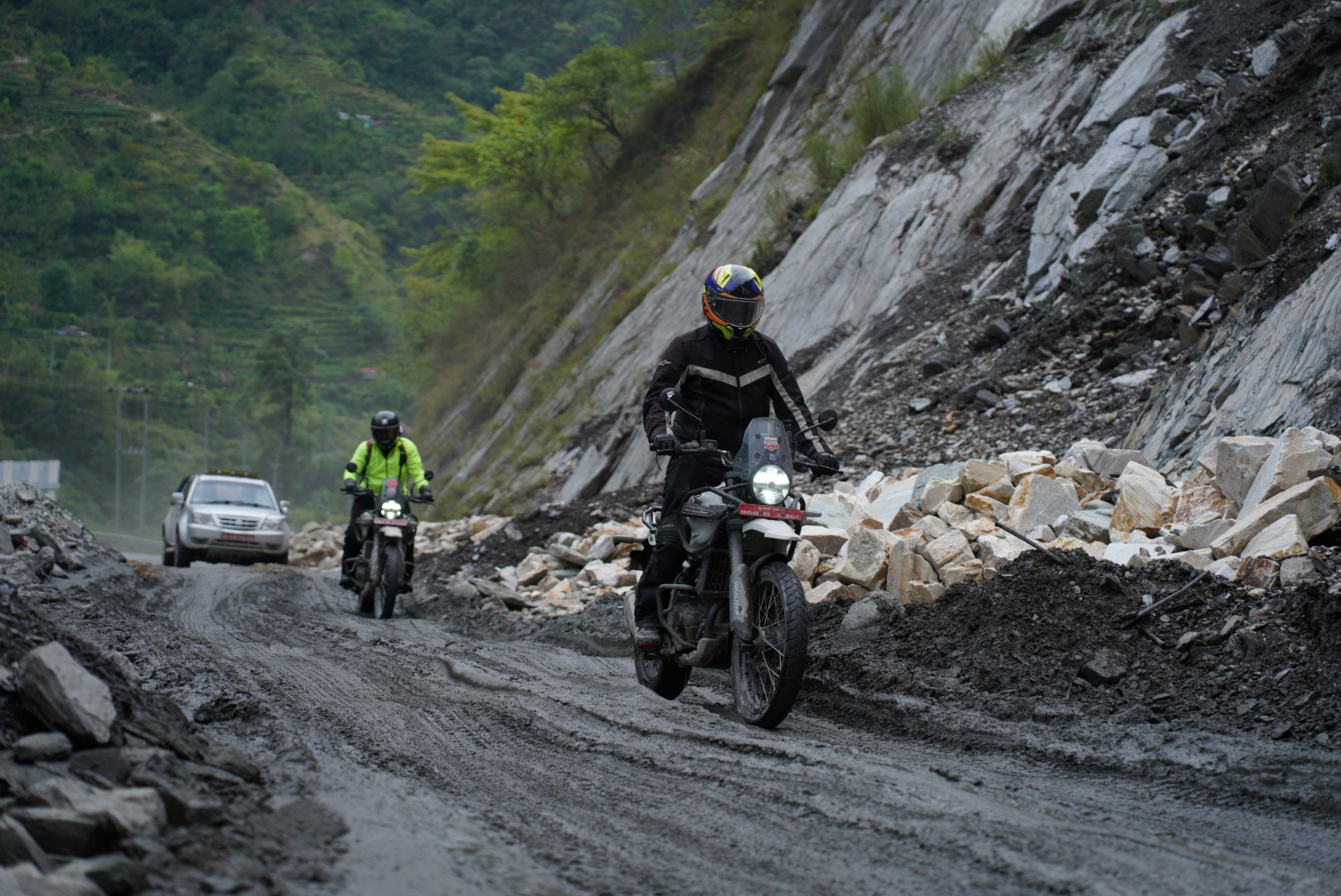
The riding itself is not the kind of riding that most people have done before their first Nepal trip — and this is true regardless of how many kilometres a rider has logged in their home country. Nepal's roads are adaptive rather than formulaic. They change character within minutes. A smooth blacktop descent becomes a gravel river crossing becomes a cobblestone village lane becomes a canyon cliff road with no guardrail. The transitions are constant, the surface variables are high, and the navigation is genuinely active rather than GPS-following.
This adaptive quality is what experienced riders travel from the UK, US, Germany, and Australia specifically to encounter. It is not available at home. It is not available in Thailand or Vietnam or even most of Ladakh, which has higher altitude but more standardised route character. Nepal's terrain variety, compressed into distances where you can ride from subtropical to alpine in a morning, is its structural advantage over every alternative Himalayan riding destination.
8. What the Riding Actually Feels Like by Region
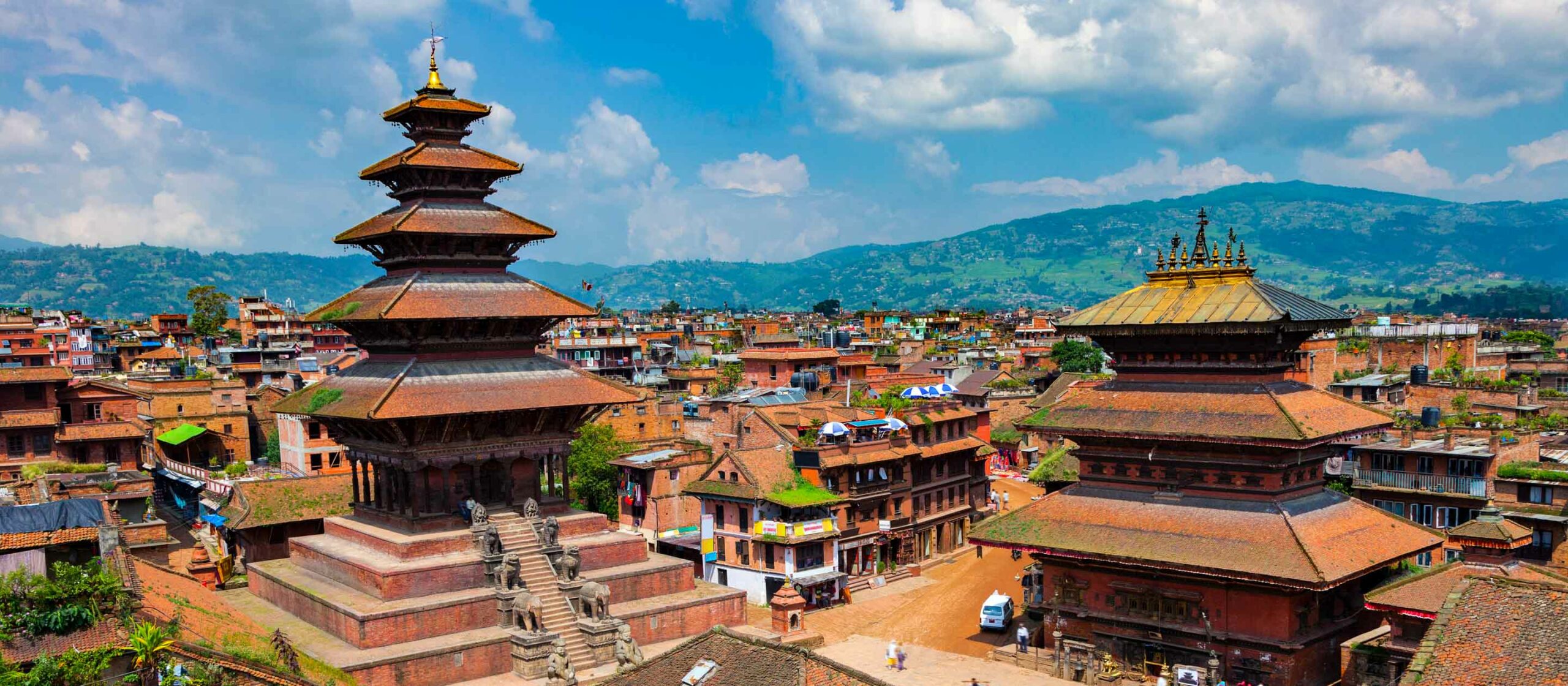
Kathmandu Valley
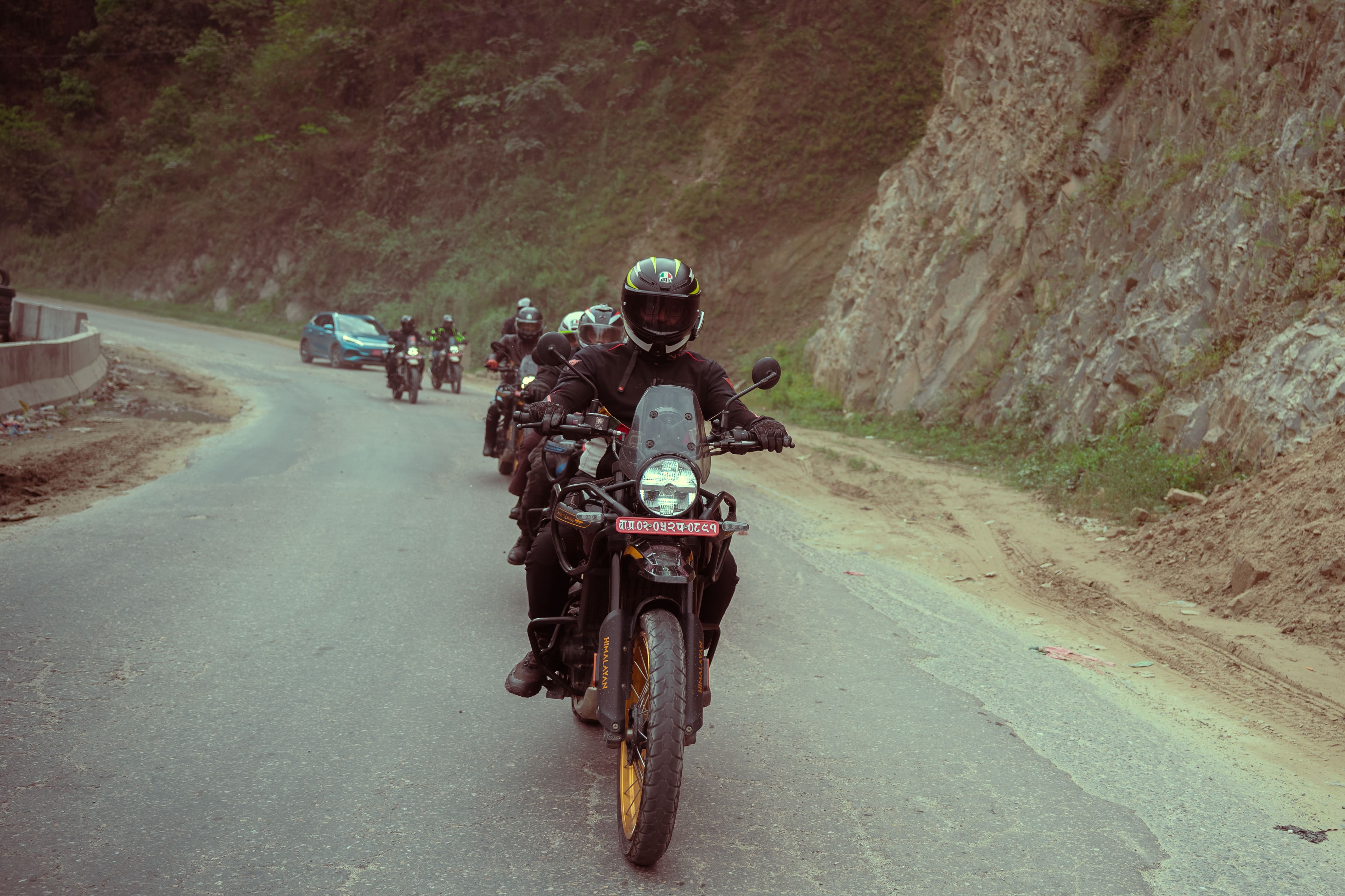
For riders new to Nepal, the Kathmandu Valley loop is the best first day's riding in the country. Within 30 kilometres of Thamel, the roads climb to 2,175 metres at Nagarkot, pass through medieval Newari towns, traverse pine forest sections, and deliver a Himalayan panorama — from Ganesh Himal to the Everest group — on a clear morning. Traffic is light beyond the Ring Road. The roads mix smooth blacktop with occasional rough sections. The riding is engaging without being technical.
This is also the calibration day. Nepal's traffic culture — left-hand driving, unpredictable overtaking from all directions, cattle that do not yield to motorcycle engines — takes adjustment. The Kathmandu Valley loop provides this calibration in a relatively forgiving environment before the higher-stakes terrain of the trail routes further north.
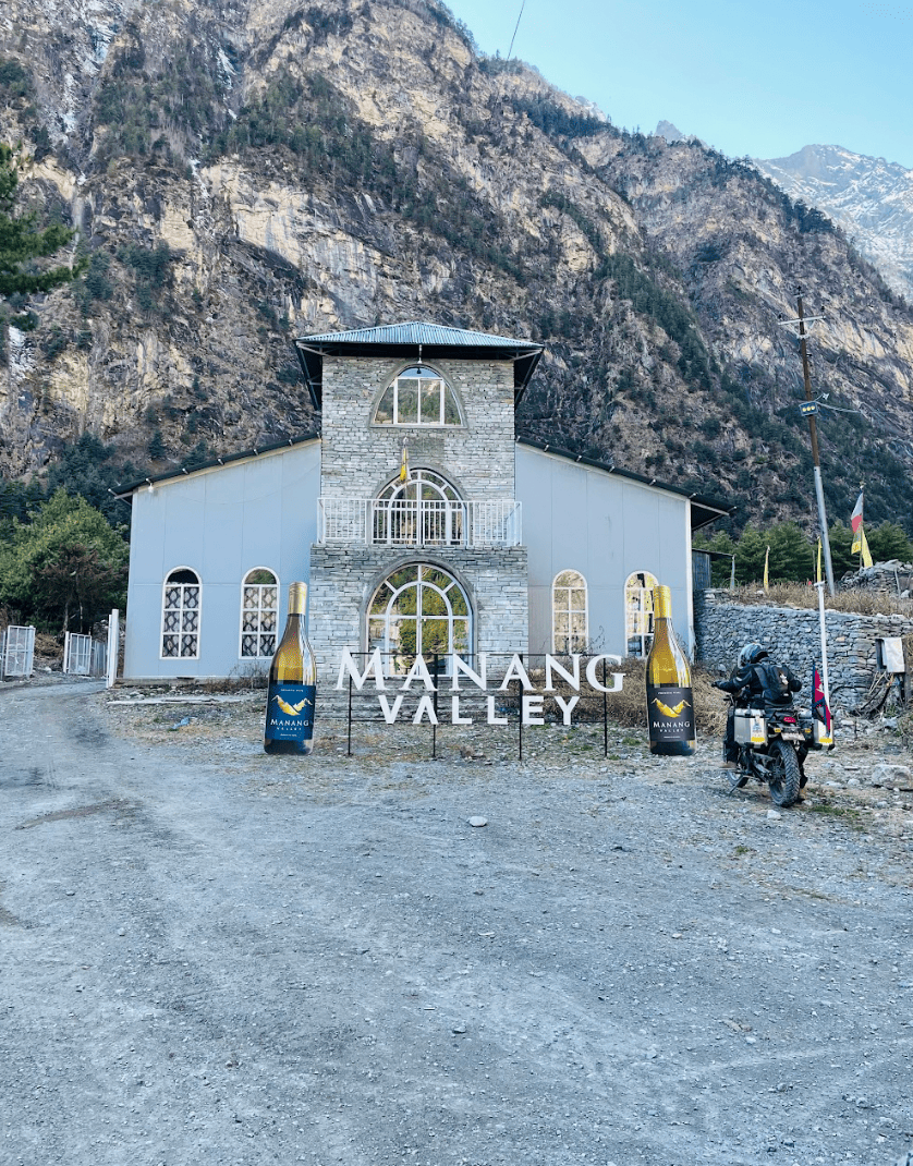
Pokhara Region
Pokhara riding is Nepal at its most visually generous. The lake perimeter roads, the approach to Sarangkot, the routes toward Ghandruk and Ulleri through terraced farmland with the Annapurna massif behind every viewpoint — this is the Nepal that appears on motorcycle tourism imagery, and it earns its representation. The roads here are predominantly paved, the riding is flowing rather than technical, and the stops — lakeside chai, viewpoint cafés, village teahouses — are spaced perfectly for a day with an afternoon photography goal.
The Mustang Approach: Beni to Jomsom
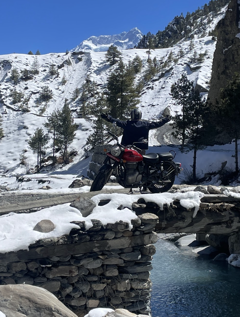
The Beni to Jomsom section is where the riding character fundamentally changes. This is the Kali Gandaki River corridor — the world's deepest gorge — and riding it north from Beni requires a recalibration of what "road" means. River crossings where the depth varies by day. Shale sections where the surface shifts under the tyre mid-corner. Wind in the afternoon that opposes forward motion with a force that requires physical resistance. Sections of track carved from cliff faces with views that make the rider simultaneously grateful and aware.
This is not recreational riding. It is expedition riding, and the distinction matters. The engagement level is total. The landscape is extraordinary. The combination produces the specific state that veteran guides and experienced riders consistently describe as the most memorable riding of their lives.
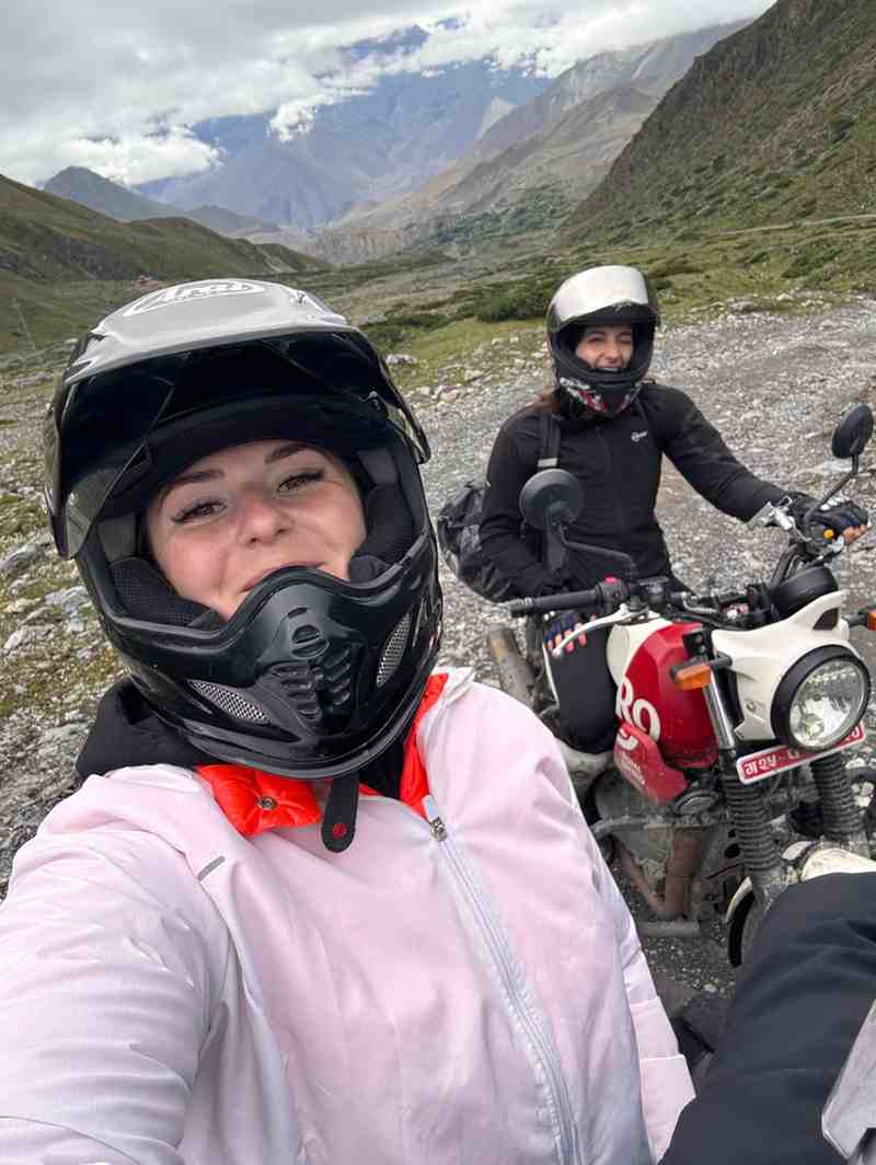
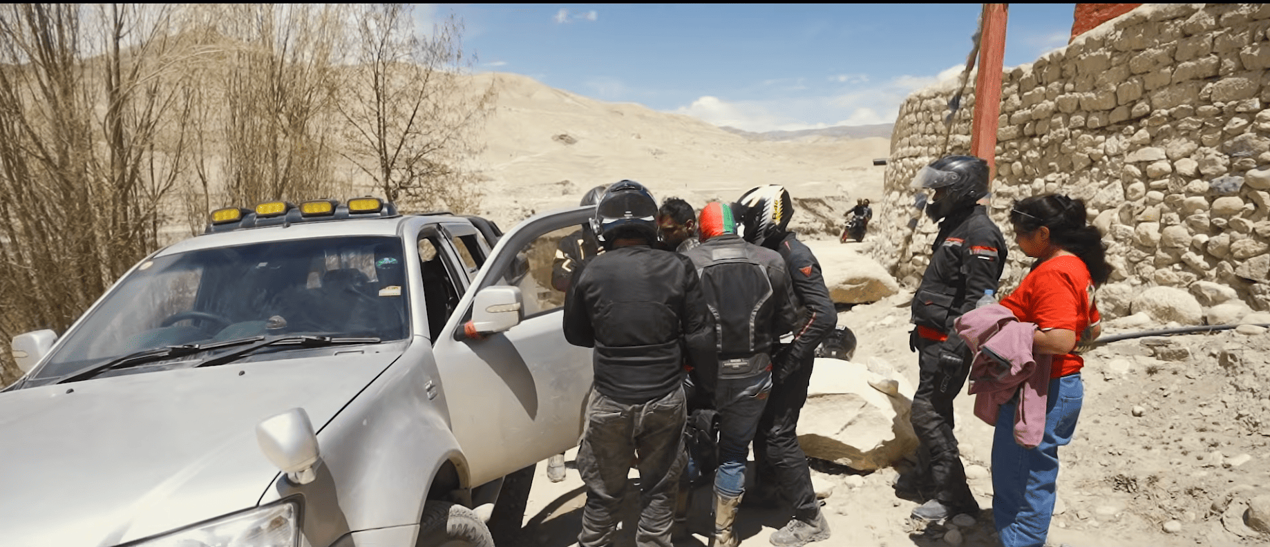
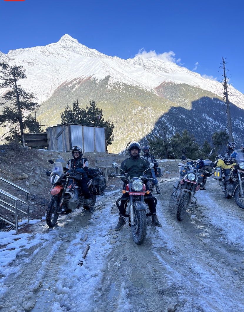
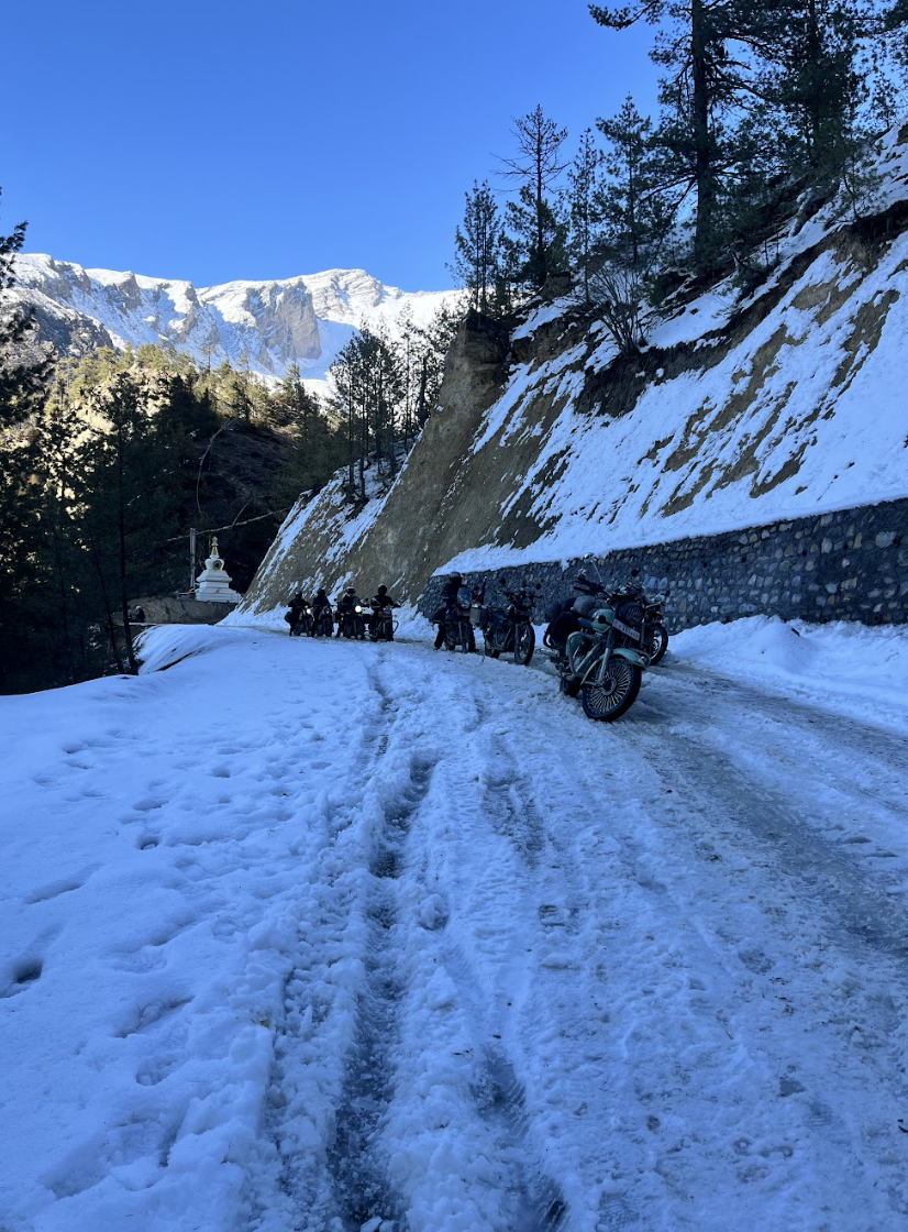
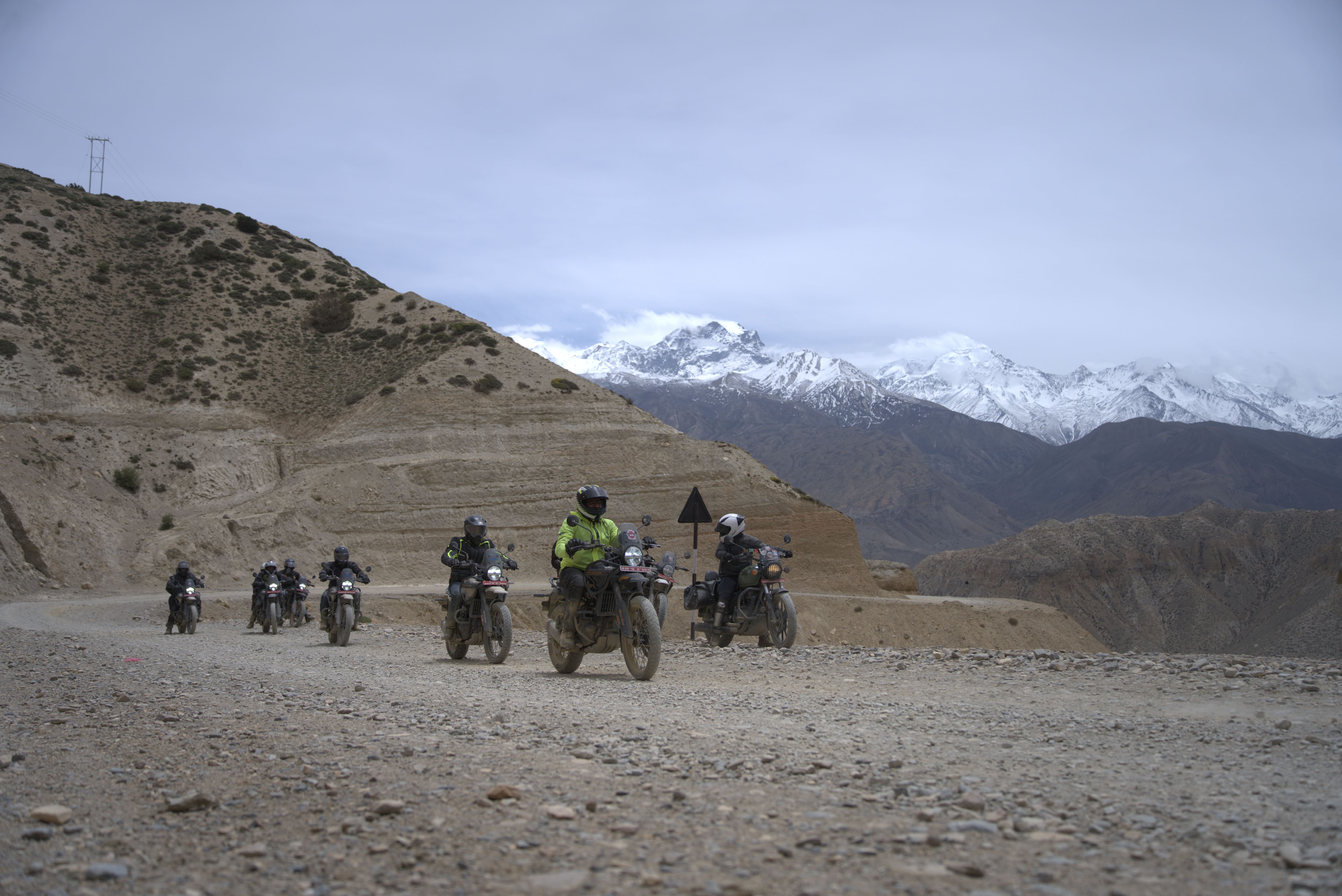
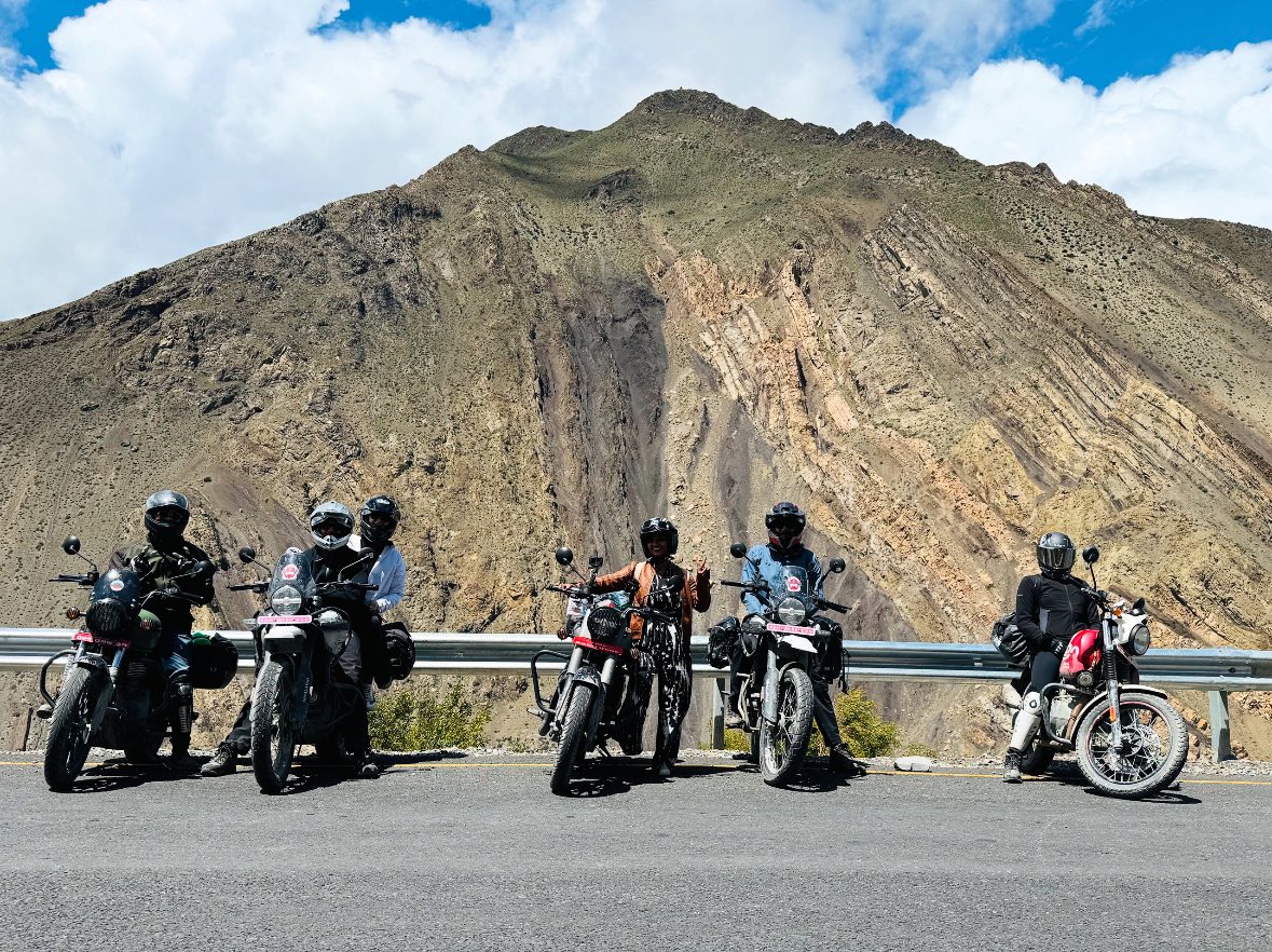
Upper Mustang: Kagbeni to Lo Manthang
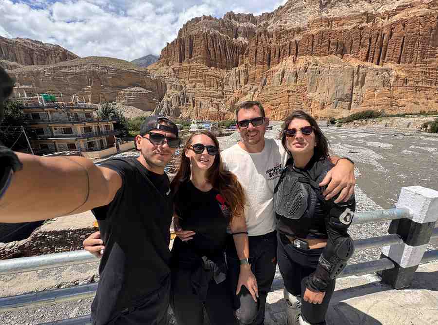
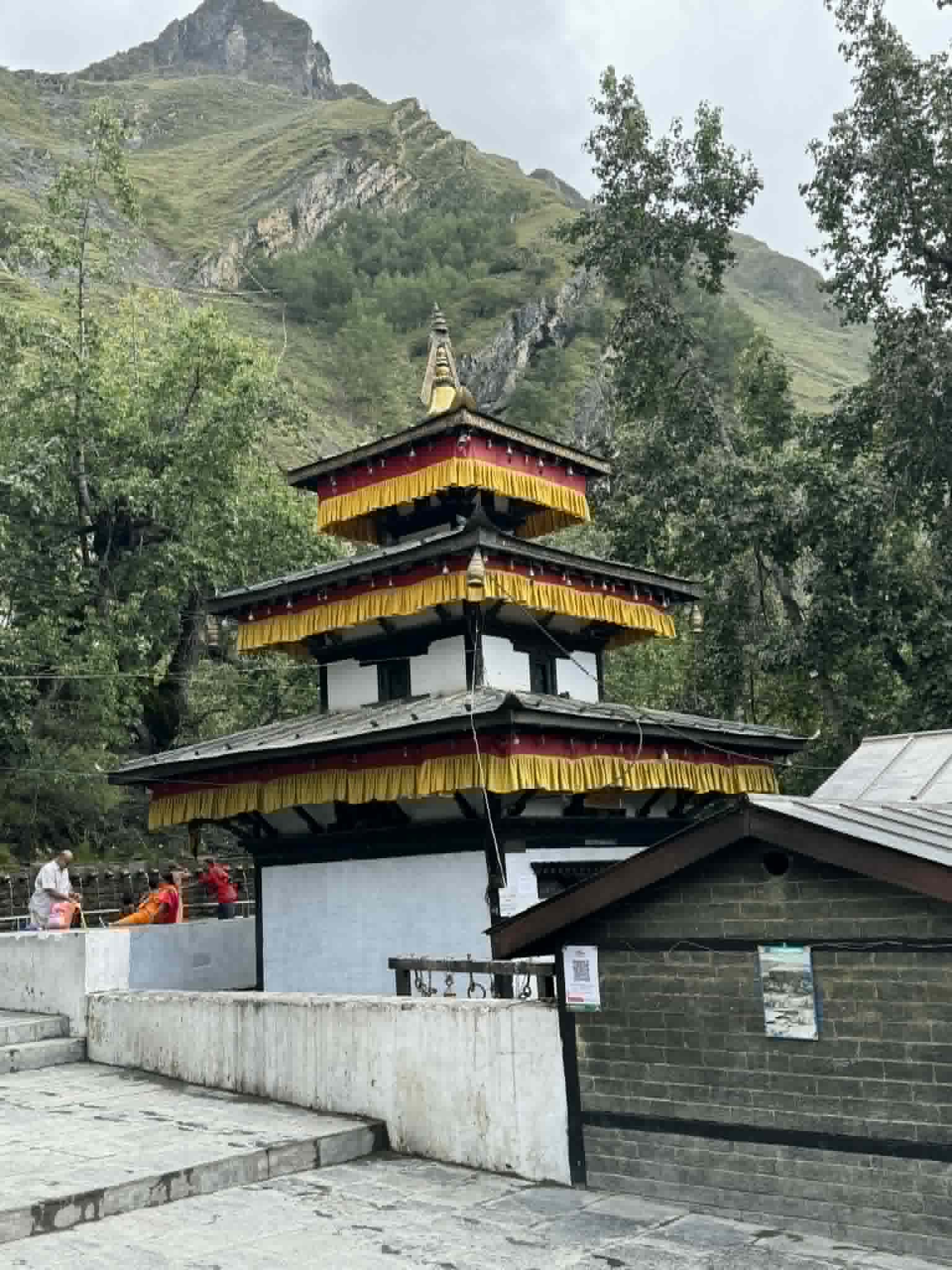
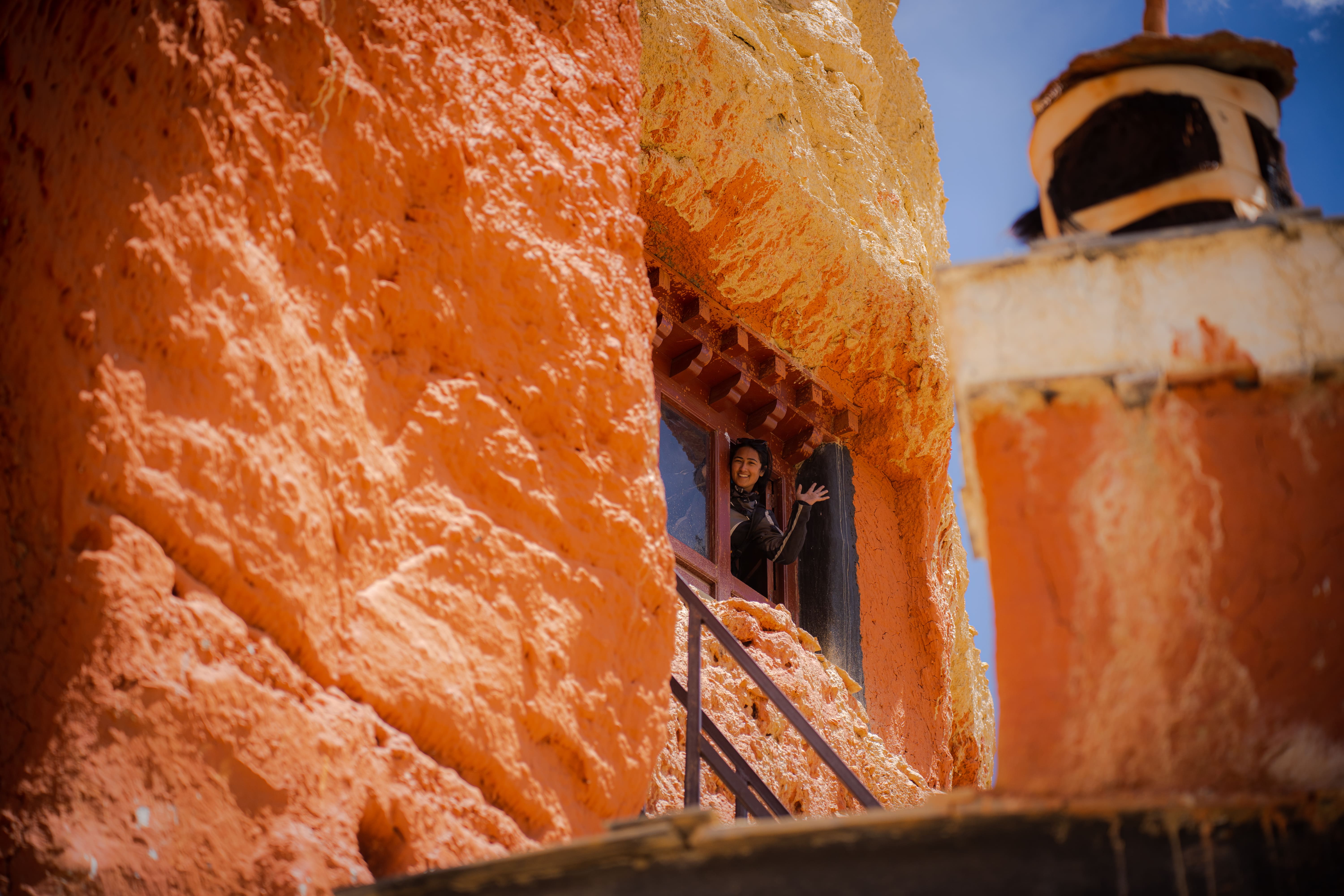
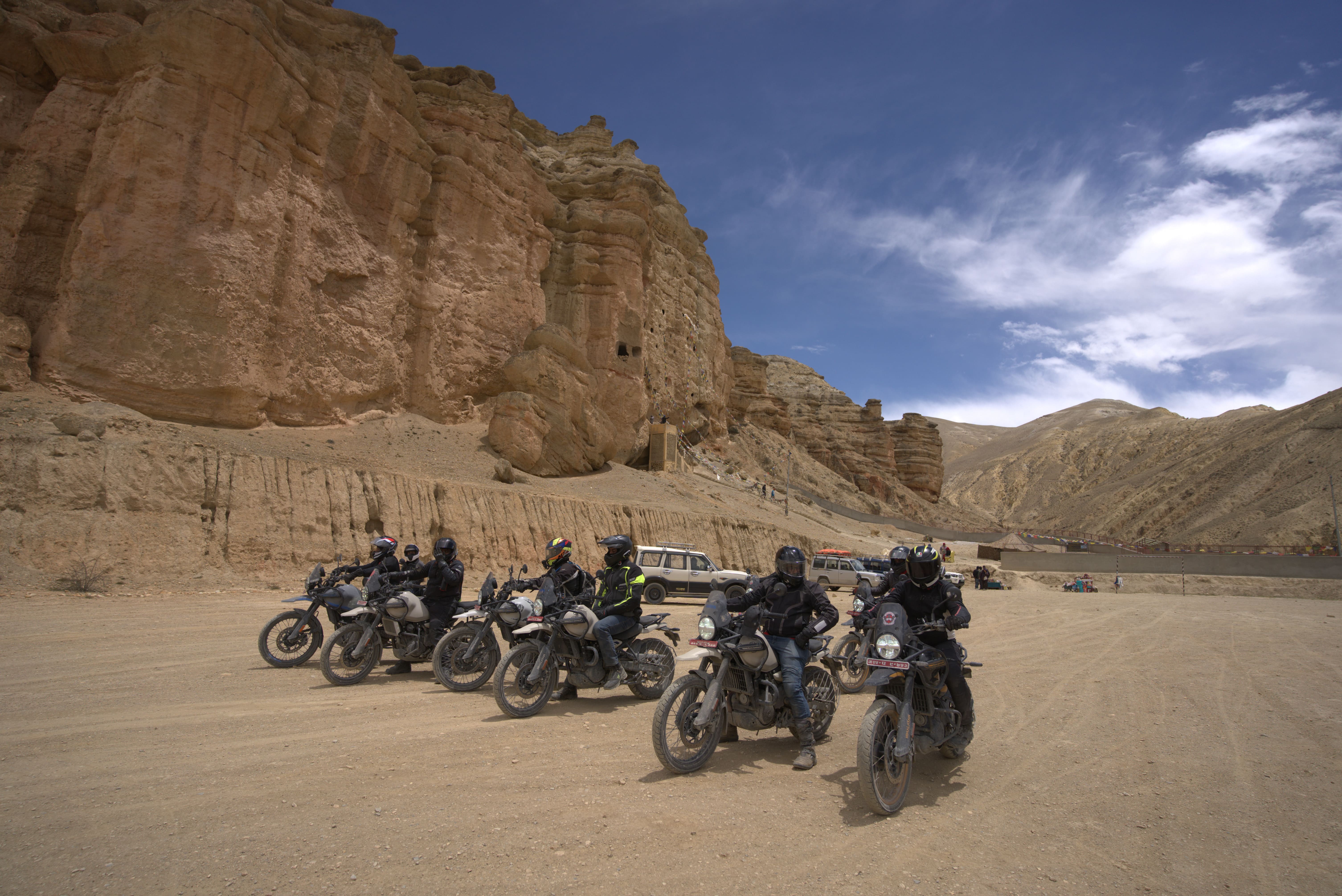
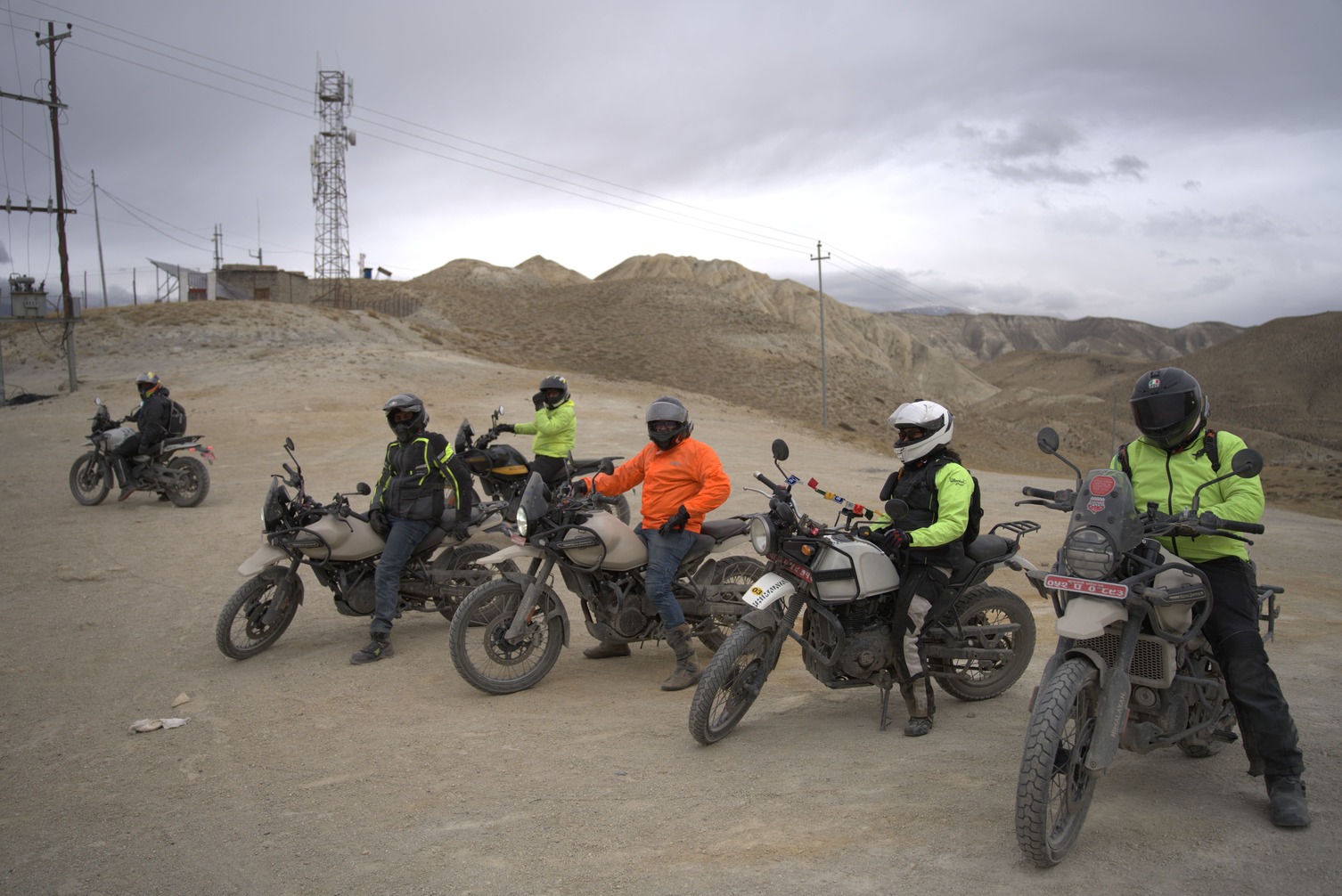
Above Kagbeni, the landscape becomes Tibetan in a way that no description adequately prepares you for. The vegetation disappears. The palette shifts to ochre, red, and grey. The canyon walls rise to 800 metres on both sides. The villages — Chele, Samar, Ghami, Tsarang — appear like anchors in the wilderness, each with its monastery and prayer flag field and population of a few hundred Loba people who have been living in this high-altitude desert for centuries.
Riding this section is not fast. It is deliberate. Every kilometre demands assessment — the loose river gravel between Ghami and Tsarang, the cliff track approaches to village entrances, the exposed plateau sections where wind and altitude combine. The Royal Enfield Himalayan 450 or Honda CRF 250L — the standard tour fleet bikes — are the right tools for this terrain. The 450's fuel injection handles altitude well. The CRF's lightweight makes river crossings and technical sections more manageable.
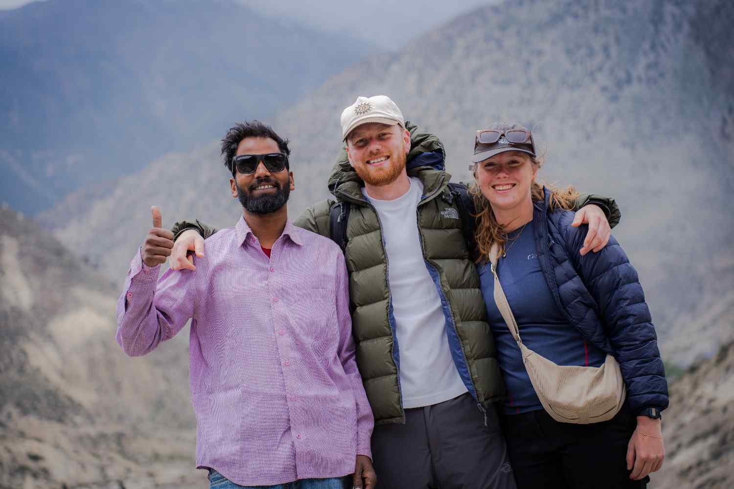
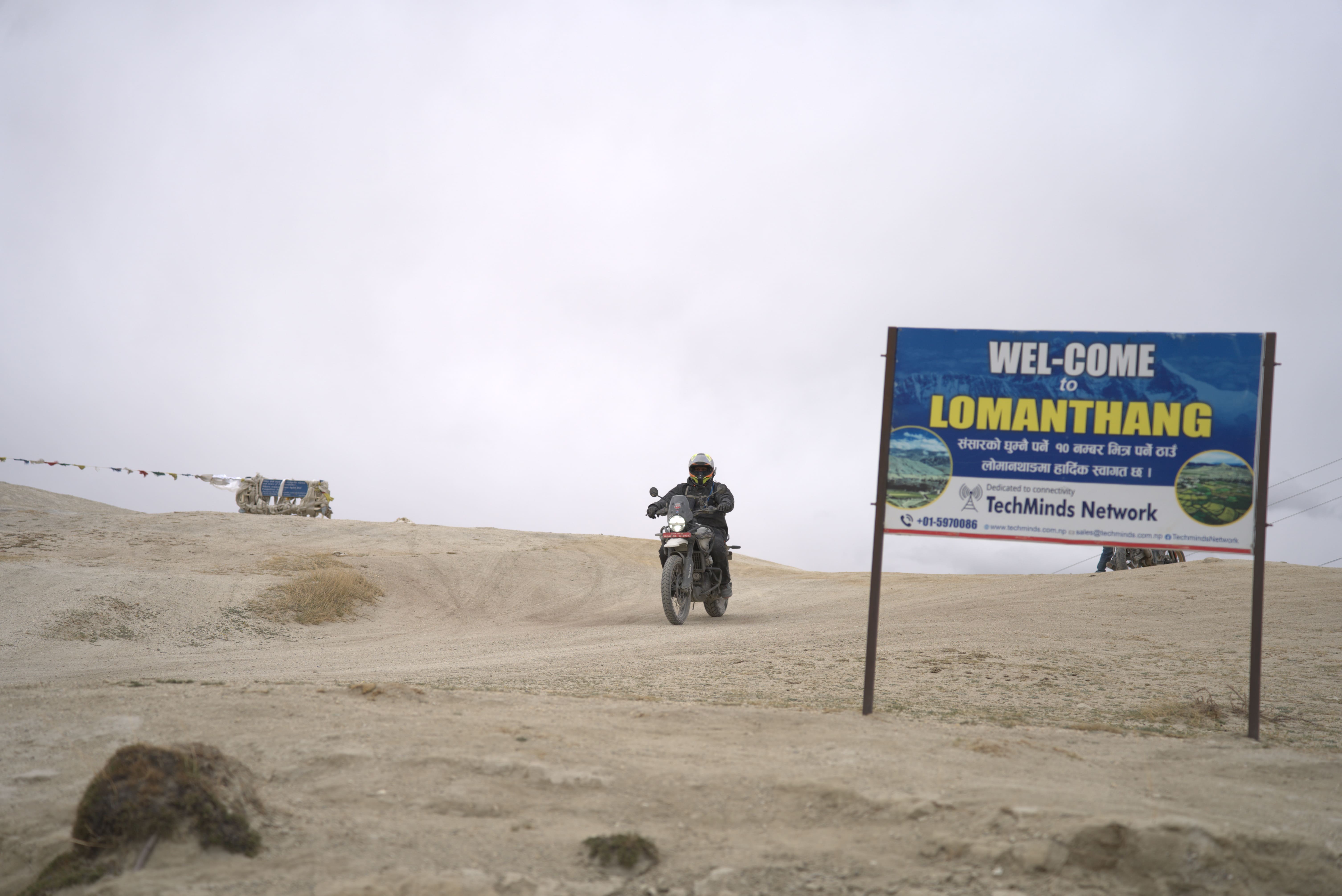
Lo Manthang arrives like a reward. The medieval walled city — still inhabited, still governed by traditional royal lineage, still containing monasteries with 700-year-old murals — is the kind of destination that motorcycle nomads write about differently from everything else on the route. It is not a viewpoint or a café stop. It is a place where you sit with what you have just ridden through.
9. 1:30 PM — Scenic Stop and Lunch
Lunch in Nepal motorcycle nomad life is never rushed, never elaborate, and rarely disappointing in the ways that matter.
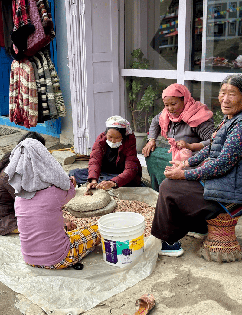
Dal bhat — rice, lentil soup, seasonal vegetables, and usually a small portion of pickle and papad — is the meal that appears most reliably across every region, every elevation, and every style of establishment from roadside stall to teahouse dining room. It is filling, caloric-dense in the right way for physical activity, and almost invariably freshly prepared. The Nepali saying that dal bhat gives "24-hour power" is only slight hyperbole. For motorcycle riding at altitude, where energy expenditure is higher than it feels because the cold and the concentration draw more than a sedentary hour would, dal bhat is functionally excellent fuel.
In Pokhara and Kathmandu, the lunch options diversify considerably — pasta, sandwiches, wood-fired pizza, Korean bibimbap, Japanese ramen, and a growing range of Nepali-fusion options crowd the lakeside and Thamel menus. For digital nomads with dietary preferences or requirements, these urban centres handle them without difficulty.
On the trail routes above Jomsom, menu options narrow as altitude increases. Thukpa (Tibetan noodle soup), butter noodles, and rice-based dishes are available in every village teahouse. Variety decreases; quality remains consistent. The simplicity is part of the environment's character. Riders who arrive in Lo Manthang expecting menu variety find instead a cooking culture that has remained essentially unchanged for generations — which, given the context of a 700-year-old walled kingdom, feels entirely appropriate.
The lunch stop in motorcycle nomad life is also the social anchor of the day. Other riders at the same teahouse, local drivers waiting out the afternoon wind, guides eating with their groups — these conversations are where information travels. Road conditions ahead. A washed-out section three kilometres north. A festival in the next village that nobody's itinerary mentioned. The informal intelligence network of mountain road travellers operates through these stops.
10. 3:00 PM — Afternoon Ride or Light Exploration
The afternoon phase is the most variable part of the motorcycle nomad day, shaped by how the morning's riding went, what the weather is doing, and what stage of the route you are on.
In the Kathmandu Valley and Pokhara region, the afternoon typically means continuing the loop, stopping for photography at viewpoints that the morning's angle didn't favour, or discovering the kind of secondary road that appears on no map but was mentioned by a local at lunch. Nepal's secondary road network — the lane between Panauti's heritage temples, the track toward Namobuddha through terraced farmland — holds the country's best discovery riding precisely because so few people think to look for it.
On the Mustang route, the afternoon is dictated by wind. The Kali Gandaki valley generates powerful, consistent afternoon updrafts from approximately 1 pm onward that are locally famous and internationally documented. Riding into these winds on a section of exposed plateau road between Ghami and Tsarang at 3 pm with a loaded bike is a form of physical labour that uses the rider's entire upper body. Experienced guides and operators build their daily stages specifically to arrive at the next overnight stop before the worst of it. Afternoon riding in this corridor is for short hops between villages, not for covering distance.
Village exploration fills the gap where riding is impractical. The villages along the Upper Mustang route reward walking that motorcycle riding bypasses. The monasteries — many of which have remained architecturally unchanged for centuries — are accessible only on foot. The encounter with local life in these settlements, where your arrival on a motorcycle from a foreign country is genuinely novel rather than a routine tourist interaction, generates the kind of unscripted experience that structured tourism rarely achieves.
For motorcycle nomads with a content creation dimension to their work, the afternoon light in Nepal's mountain valleys is specifically photographic. The late afternoon sun at 3,500 metres, filtered through the dry air of the upper valleys, produces a golden quality that landscape photographers travel specifically to find. The combination of riding, stopping, and shooting is a rhythm that the afternoon window accommodates naturally.
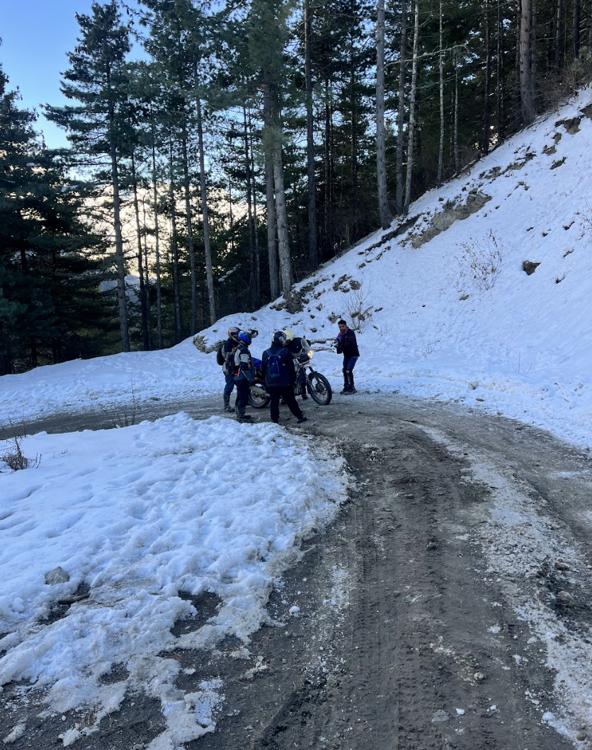
11. 5:00 PM — Return and Recovery
The riding day ends before fatigue becomes a decision-making variable. This is not a soft preference — it is a safety principle. Nepal's roads, challenging enough in good physical condition and clear daylight, become disproportionately more demanding when a rider is tired. The judgments that moderate fatigue impairs — line choice on loose surface, speed assessment for river crossings, reaction to unexpected obstacles — are precisely the ones that matter most on Nepal's terrain.
The standard motorcycle nomad practice is to plan riding stages that conclude by 4 to 5 pm, leaving adequate daylight and physical reserve for the final approach to the overnight stop. This planning discipline is easier in the Kathmandu Valley where stages are shorter and accommodation is dense. On the Mustang route, where stages are longer and stops more spaced, it requires earlier starts and more disciplined lunch stop management.
Returning to the guesthouse or hotel triggers a consistent recovery sequence.
The shower first — and it matters more than it sounds. Nepal's unpaved routes generate dust that infiltrates every layer of clothing and settles into hair and skin in ways that only becomes apparent under running water. The shower is not comfort — it is the transition between the physical riding state and the evening cognitive state. Riders who skip it find the mental carry-over of the day's road dust into the evening's work or rest more significant than expected.
Stretching follows. Six hours on a motorcycle through varied terrain works specific muscle groups — hip flexors, lower back, shoulders from wind resistance, forearms from grip — in ways that a static day of desk work does not. The cumulative stiffness across a multi-day Nepal expedition is manageable with a consistent 15-minute evening stretch and significant without it. This is not theoretical advice from a physiology text. It is the lived experience of every rider who has completed a Nepal tour of more than a week.
Bike maintenance is the third element of the return phase. Even on days when nothing obviously went wrong, a brief check of chain tension, tyre condition, brake feel, and fluid levels after a day's riding on variable terrain is worthwhile. Nepal's roads are harder on machinery than they look. The loose rocks that don't slow you meaningfully still hit wheels with consistent force. Chain lubrication in dusty conditions is an every-other-day necessity rather than a weekly one.
The final element — journaling or content review — is where the day's experience gets recorded before sleep erodes the details. Experienced motorcycle nomads and content creators develop a consistent evening documentation habit because Nepal generates experience faster than memory consolidates it. Three days of Upper Mustang riding without documentation produces a blur where distinct scenes and conversations were happening. Day-end notes — even brief ones — resolve the blur into a retrievable record.
12. 6:30 PM — Evening Work and Content Window
The evening work session in motorcycle nomad life is deliberately lighter than the morning block.
In Kathmandu and Pokhara, this window typically involves email response, content editing, social media updates, and planning for the next day's stage. The cognitive load is lower than morning deep work — partly by design, partly because the day's physical activity has produced a pleasant neural tiredness that makes deep analytical work harder but makes curation, editing, and communication feel natural.
Most of our guests coming for the creators expedition are mostly photographers, YouTubers, travel writers, and the growing cohort of riders building audiences around their Nepal experience. The evening window is the editing and upload session. Raw footage from the day's riding, photos from the scenic stops, audio clips from teahouse conversations: all of this gets reviewed, selected, and processed in the evening light. Connectivity in Kathmandu and Pokhara handles upload loads without difficulty. On the trail routes, uploads happen in batches on return to better-connected towns.
The work-life balance embedded in this structure is not accidental. It is the product of Nepal's specific temporal constraints, morning is best for work before the riding window opens, evening is best for light work before early sleep for early rising, operating on a human schedule rather than a 24-hour digital one. Many motorcycle nomads report that Nepal enforces better work-life boundaries than any deliberate personal system they had previously tried to maintain.
13. 7:30 PM — The Sunset Moment
In a lifestyle full of visual intensity, the sunset in Nepal's mountain landscapes occupies a specific emotional category that experienced motorcycle nomads consistently identify as the psychological anchor of the day.
In Kathmandu, sunset from Nagarkot or from the Boudha stupa rooftops silhouettes the valley's northern hills against an amber sky while the city sounds, traffic, distant music, prayer bells — create an urban acoustic landscape unlike anywhere else. In Pokhara, the Annapurna range catches the last light at angles that change colour every ten minutes from orange through pink to grey, reflected in the lake surface with a doubling effect that amplifies the whole. In Upper Mustang, the desert plateau at sunset produces the most dramatic light of any Nepal location — the red cliffs of Ghami and Tsarang radiating warmth while the sky above transitions through colours for which the English language has insufficient vocabulary.
What the sunset does functionally, in the psychological architecture of the motorcycle nomad day, is mark the hard boundary between effort and rest. The work is done. The riding is done. The remaining hours are for food, conversation, and wind-down. The sunset makes this boundary visible in a way that office walls and computer screens do not. It is a punctuation mark written at a civilisational scale.
Many motorcycle nomads in Nepal nomad ride report that the consistent quality of this daily closure — the definitive end of the active day marked by something genuinely beautiful, has effects on their mental health and creative productivity that persist beyond the Nepal trip. The habit of noticing the end of the day, of marking the transition from doing to being, is easier to form in Nepal than almost anywhere else because Nepal makes the transition unmissable.
14. 8:00 PM — Dinner and Social Time
Dinner in Nepal is the most social meal of the day, and in a motorcycle nomad lifestyle — which by definition involves significant solo or small-group experience — this social dimension matters more than it might in conventional travel.
In Kathmandu, dinner is whatever you want it to be. The Thamel restaurant ecology covers Indian, Tibetan, Chinese, Japanese, Korean, Italian, and Nepali cuisines across a price range from budget dal bhat to mid-range tasting menus. The choice has a decompression quality after days on trail routes where the menu is dal bhat or noodles. Most motorcycle nomads find themselves craving the simplicity of teahouse food within 48 hours of returning to the city.
In Pokhara, lakeside dinner is one of the more civilised experiences available in Nepal motorcycle nomad life. Tables by the lake, the faint reflection of lights on the water, reasonable wine, good food, and the daily social convergence of a town that has been gathering adventure travellers for decades. The conversations at Pokhara dinner tables are worth sitting at for an hour even if you are not hungry.
On the trail routes, dinner is communal by the architecture of teahouse life. The dining room is shared. The table is long. The people at it arrived from different directions, are heading to different destinations, and have had different days — but the mountain road context creates an immediate common ground that urban social settings rarely achieve as quickly. Routes compared, weather discussed, riding challenges laughed about after the fact: the teahouse dinner table is where the day gets processed socially rather than privately.
In guided motorcycle expeditions, dinner is often a group debrief as well as a meal — the guide reviewing the next day's stage, the group sharing notes on what was difficult or exceptional about the day's riding, mechanics reporting on any bike issues that need attention before morning. The structure is informal but functional.
15. 9:30 PM — Wind Down and Preparation
Motorcycle nomads in Nepal tend toward early sleep, not from lack of enthusiasm but from biological alignment with the mountain schedule. The day starts early because the riding window opens at noon and the morning work block begins at eight. Early rising requires early sleeping. Nepal enforces it.
The wind-down is quiet and consistent. Slow music or the silence that only achieves this quality at altitude. Photo and video editing if the evening work session didn't cover it all. The journal entry that records the day with enough detail to be useful later. Gear preparation for tomorrow, jacket, gloves, and helmet positioned for a quick exit, riding boots checked for the dust that always finds its way in.
Tomorrow's route was reviewed one more time: stage distance, elevation change, potential fuel stops, weather outlook. Not with anxiety, but with the specific quality of practical preparation that experienced riders develop — comfortable with uncertainty, clear on the variables that matter and relaxed about the ones that don't.
Phones go down at 10 pm. Sleep comes easily. The body has earned it.
16. Day Variations: Not Every Day Is the Same
The structure described above is the standard day — what a typical motorcycle nomad session in Nepal looks like when all variables align. In practice, across a 30-day program, the days distribute across three distinct modes.
The Work-Heavy Day
On some days — when a deadline lands, when a client needs sustained attention, when the weather closes the riding window — the day becomes predominantly digital. No riding. Full coworking session from morning through mid-afternoon. Content production, planning, calls, deep output.
These days serve a specific function in a long program: they provide the financial and professional grounding that makes everything else sustainable. A 30-day Nepal program is not a holiday. It is a work-enabled lifestyle that requires the work to actually happen. The work-heavy days are what make the ride-heavy days responsible.
In Nepal's urban centres — Kathmandu particularly — these days are not difficult. The coworking infrastructure is adequate, the café culture is good, and the environment has enough interest at street level that a day spent mostly at a desk still generates more sensory variety than the equivalent day in a home office.
The Ride-Heavy Day
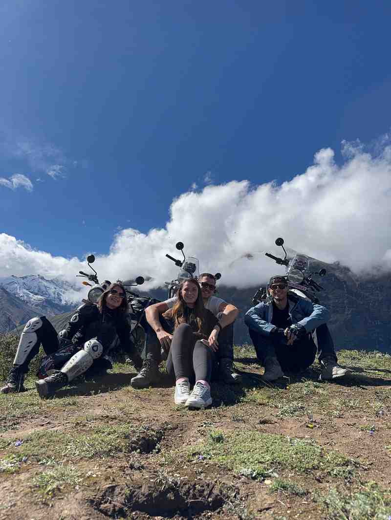
Periodically, the schedule opens fully for riding. No meaningful work obligation. Full-day route. Photography focus. The kind of day where you leave at 8 am, stop for nothing except lunch and significant viewpoints, and return at 5 pm having covered 150 to 200 kilometres of terrain that took everything you had.
These days are the experiential peak of the motorcycle nomad program. They are also the most physically demanding and the ones that most reliably produce the state that riders spend years trying to describe — total absorption, no residual mental noise, complete presence in motion through an extraordinary landscape.
The Expedition Day
On the deep trail sections — Upper Mustang approach, Thorong La crossing, western Nepal frontier routes — the day becomes what the industry calls an expedition day. Everything is riding. Stages are long, terrain is demanding, stops are minimal, and altitude adds a constant background load to every decision and movement.
Expedition days are not frequent in a balanced 30-day program — perhaps five to eight concentrated in the high-altitude sections — but they define the program's outer edge. They are the days that people most frequently describe when someone asks what the experience was like, because they represent the full combination of everything Nepal motorcycle nomad life is about: technical riding, physical commitment, altitude exposure, cultural distance, and the specific quality of landscape that exists only above 3,500 metres in the western Himalayan rain shadow.
17. Nepal vs. Other Digital Nomad Destinations
The comparison matters because choosing Nepal for a 30-day remote work program involves trade-offs that are worth naming honestly.
Bali: Better established coworking infrastructure. More reliable internet across the island. Larger English-speaking nomad community. No motorcycle terrain comparable to Nepal's Himalayan routes. The riding is pleasant but operates in a different category — recreational cruising through rice paddies versus expedition riding through high-altitude desert.
Chiang Mai: Outstanding coworking ecosystem, arguably the best-developed digital nomad infrastructure in Asia. Cheap, stable, socially rich. The mountain riding north of the city is genuinely good. But the elevation tops out around 2,565 metres at Doi Inthanon, and the terrain character — accessible, well-maintained, predictable — does not produce the specific type of riding experience that brings international adventure riders to Nepal.
Lisbon: Exceptional internet connectivity, strong food culture, European timezone advantages for remote workers serving European clients. No mountains within riding distance that approach Nepal's scale or terrain variety.
Tbilisi: Emerging nomad hub with good value and beautiful Georgian landscape. The Caucasus mountain riding is underrated internationally. But Georgia's highest paved pass tops at approximately 2,700 metres, compared to Nepal's 5,416-metre Thorong La, and the cultural depth accessible by motorcycle in Nepal — restricted kingdoms, ancient monasteries, Tibetan Buddhist villages — has no Georgian equivalent.
Nepal's specific advantage over every alternative is the combination: Himalayan terrain, cultural depth, motorcycle accessibility, genuine adventure, and a cost structure that makes 30-day programs financially viable for the demographic of riders who most want the experience. That combination exists nowhere else.
The honest disadvantages: the internet is not globally reliable, particularly above Pokhara. Urban connectivity in Kathmandu and Pokhara is adequate for most remote work but will frustrate those who need consistently high-bandwidth video production workflows. Food variety in remote sections is limited. Medical infrastructure outside Kathmandu is basic.
For riders who have done the conventional nomad circuit and are looking for something that cannot be described by reference to anything they have already done — Nepal is the answer the comparison produces.
18. The Inner Shift: What This Lifestyle Does to You
The most consistent thing people say about a month of motorcycle nomad life in Nepal is that they did not expect what changed.
They expected the landscape — they had seen the photographs. They expected the riding to be challenging — that was the point. They expected the remote work to be manageable — they had a functional setup.
What they did not expect was the cumulative effect of the rhythm.
The daily alternation between focused cognitive work and physically demanding environmental navigation — between the deep focus of a morning work block and the adaptive attention of a Himalayan afternoon ride — appears to produce a specific cognitive state that very few conventional environments generate. The work gets sharper. The riding gets more intuitive. The evening feels genuinely complete in a way that most days, even good ones, don't.
The Chhomrong to Deurali effect — the psychological shift from resistance to acceptance described by every rider who has pushed through a difficult mountain section — happens across the full month as well as within individual riding days. The uncertainty of Nepal's roads, the unpredictability of conditions, the requirement to respond rather than to control — these expose and then gradually dissolve the planning-anxiety that remote work tends to reinforce. You stop trying to schedule everything and start reading conditions instead.
That shift — from scheduling to reading, from controlling to adapting, from outcome-focused to process-present — is what people mean when they say Nepal changed how they work. Not what they do. How they do it.
A 30-day motorcycle nomad program in Nepal is, among other things, an extended education in the difference between those two things. And most people who experience it find that the education lasts considerably longer than the month.
19. Frequently Asked Questions
Do I need riding experience to do a motorcycle nomad program in Nepal? Meaningful off-road and mixed-terrain riding experience is necessary for the full Himalayan route sections. For programs based predominantly in the Kathmandu Valley and Pokhara region, intermediate road riding skill is sufficient. Be honest about your level when selecting a program — reputable operators like Nepal Moto Tours assess this carefully because the terrain genuinely requires it.
What internet speed should I expect for remote work? Kathmandu: 50–200 Mbps in good coworking spaces, 20–50 Mbps in cafés. Pokhara: 20–50 Mbps. Jomsom: intermittent 4G that handles email and messaging. Above Kagbeni: largely absent. Plan your work schedule around the connectivity geography, not the other way around.
Is a 30-day program necessary, or can I do a shorter version? A 10 to 14-day program captures the Kathmandu–Pokhara–Upper Mustang highlights and is sufficient for a first Nepal motorcycle experience. The 30-day program specifically enables the lifestyle rhythm described in this article — the slow alternation between deep work, trail riding, and cultural immersion that produces the cumulative internal shift. Two weeks shows you Nepal. A month lets Nepal change you.
What motorcycle will I ride? The Royal Enfield Himalayan 450 is the most widely used bike for Nepal motorcycle tour programs as of 2026 — fuel-injected, altitude-competent, locally serviceable, and purpose-designed for the terrain it is named after. The Honda CRF 250L is the preferred choice for more technical off-road sections. Both are available through reputable Kathmandu rental shops and are included in guided tour programs.
How do I manage time zones with clients while doing a month in Nepal? Nepal Standard Time (NPT) is UTC+5:45 — one of only two non-integer offset time zones in the world, which makes scheduling slightly unusual. For European clients, Nepal morning work hours align reasonably with European afternoon. For US clients, the overlap is more challenging and typically requires either very early Nepal morning calls or evening Nepal calls. Most experienced nomads working the US market adopt a split schedule: early morning for calls, daytime for riding, evening for US-timezone follow-up. It is manageable with client communication and expectations set in advance.
Is Nepal safe for a solo motorcycle nomad? Nepal's general safety for foreign visitors is good — violent crime is rare and the cultural hospitality framework is genuinely pervasive. The risks specific to motorcycle nomads — road accidents, altitude sickness, mechanical breakdowns in remote areas — are real and manageable with preparation, proper insurance, and the travel-with-guide approach that Nepal's regulations now mandate in protected areas. Solo riding in Upper Mustang without a guide or backup vehicle is not recommended regardless of experience level.
What does a 30-day Nepal motorcycle nomad program cost? Full-cost estimates for a 30-day program run USD 3,500–6,000 all-in for a guided expedition with accommodation, support vehicle, and mechanical backup. Independent programs with rented motorcycle, self-arranged accommodation, and guide hired as needed run USD 2,000–3,500. Flight costs are additional. The investment is comparable to or lower than equivalent duration in Bali or Thailand when full activity costs are accounted for — and the experience is categorically different.

.jpg)

.png)

.png)
.png)