Kagbeni is a small mud-brick village at about 2,800 metres, on a bend where two rivers meet and the Kali Gandaki valley turns into the high desert. South of it, the road runs back toward Jomsom, apple orchards, and the usual tea houses of the Annapurna region. North of it lies the restricted area of Upper Mustang, the old Kingdom of Lo, reached only by a track along the riverbed and only with a permit.
Almost every rider heading to Lo Manthang passes through Kagbeni, and most spend less time here than the village deserves. This guide covers where it sits, what to see, how the permit checkpoint works, and how to plan a night or two around it.
Where Kagbeni Sits
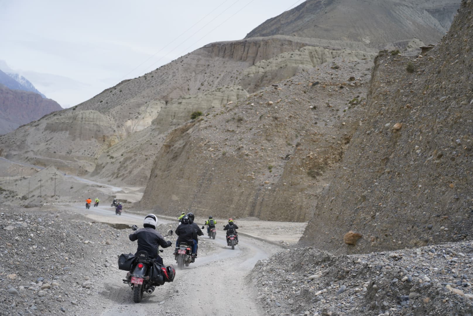
Kagbeni lies in the Mustang district of Gandaki Province, roughly 10 kilometres north of Jomsom. The road from Jomsom follows the east bank of the Kali Gandaki and reaches Kagbeni in under an hour on a motorcycle, depending on wind and surface. At the village, the road forks. One branch climbs east toward Muktinath, about 10 to 12 kilometres away, through the Jhong Khola valley. The other becomes the track north into Upper Mustang.
That fork is the reason for the village's old importance. Kagbeni sits where the trade and pilgrim route from Muktinath meets the route running north to Tibet. For centuries it was a stopping place on the salt trade between Tibet and the Nepal hills, and many traders paused here before moving on.
The Name and the Setting
Kagbeni's name combines "Kag" with "beni", the Nepali word for the meeting of two rivers. The rivers here are the Kali Gandaki and the Jhong Khola, which comes down from the Muktinath side. Sources disagree about the meaning of "Kag". Some read it as a reference to the Kali and Gandaki together, and others link it to a Tibetan word. The confluence is the part everyone agrees on, and it carries religious weight. Pilgrims come to the riverbank for rites in honour of their ancestors, and the black stones in the riverbed include shaligrams, the ammonite fossils that Vaishnava Hindus treat as natural forms of Vishnu.
The setting is what stays with most riders. Kagbeni stands on a spur above the riverbed, and green barley fields and apple trees cluster around it. Beyond the village, the landscape turns to bare ochre and grey cliffs. The contrast between the green village and the dry desert behind it is sharp, and it is visible from almost every lane.
A Short History
Kagbeni has been settled for a long time, and its position at a trade junction gave it a fort and a monastery. The ruins of Kag Khar, the old fortress above the village, still stand. They are crumbling walls of earth and stone, and the climb gives you a view of the village, the riverbed, and the track leading north.
The monastery is Kag Chode Thupten Samphel Ling, also called the Red Monastery for the colour of its walls. Sources date its founding to 1429, and credit it to the Sakya master Tenpa Gyaltsen. Its thick rammed-earth walls lean inward as they rise, a building method meant to resist earthquakes and attack. It is still active, and monks live and pray there.
What to See in Kagbeni
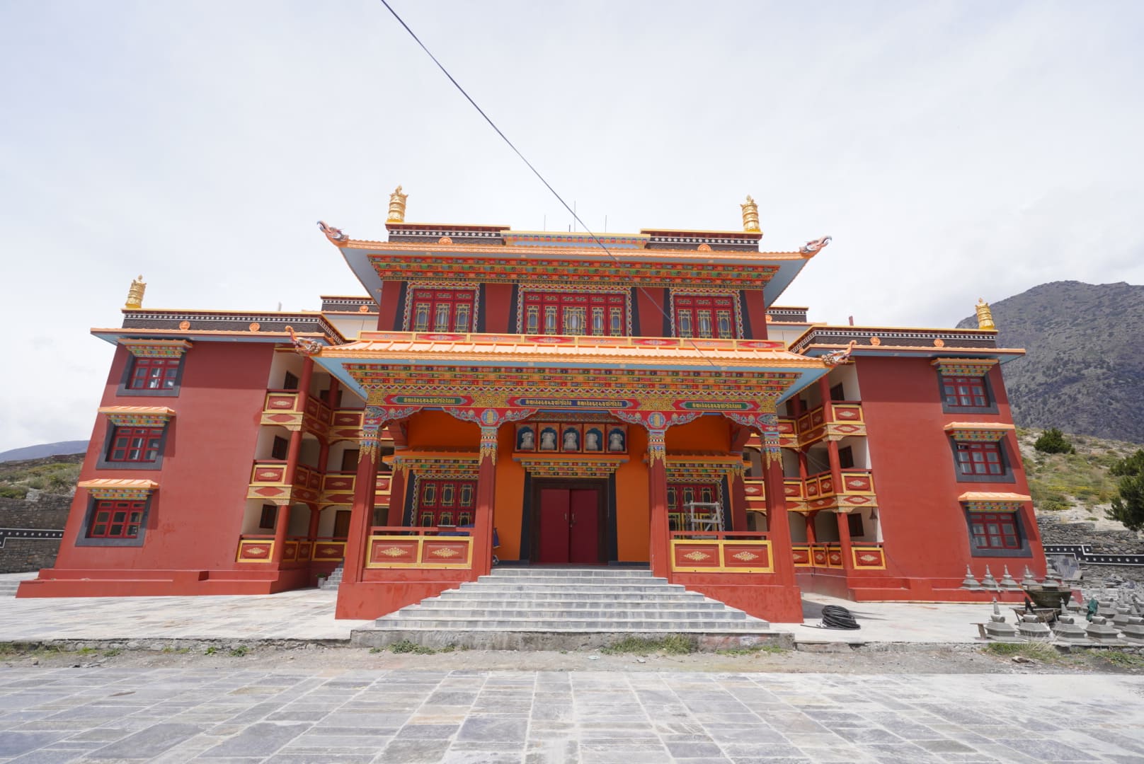
Kag Chode Monastery
The monastery is the main sight. Its assembly hall holds old murals, statues, and rows of prayer texts, and the building has the dim, quiet feel of a place in daily use. Ask permission before you enter and before taking photographs. A small donation is customary. A newer monastery building stands near the old one, and the contrast between them shows how the community has grown around its older centre.
The Village Lanes
Walk the lanes on foot. They are narrow and partly covered, with houses built of mud brick and timber, and prayer wheels set into the walls at corners. Red-painted chortens stand at the village edges. The covered passages shelter you from the wind, which is a practical reason for the building style as well as a visual one.
The Fort Ruins and the View North
Climb to what remains of Kag Khar for the best view. From the top, you can see the Kali Gandaki riverbed running north, the track that Upper Mustang riders follow, and the confluence below. In clear conditions, the peaks of the Nilgiri and Dhaulagiri ranges stand to the south and west.
The Riverbank
Walk down to the confluence in the late afternoon. Local people still use the spot for rituals, and you may see offerings in the water. Do not photograph people performing rites without asking.
Apples and Orchards
The orchards around Kagbeni produce apples, and many lodges serve apple pie, juice, and local brandy. The Marpha distillery, further south, is better known, but Kagbeni lodges often stock the same products.
The Checkpoint
Kagbeni is where the Upper Mustang restricted area begins, and a checkpoint stands at the northern edge of the village. Police inspect permits there for everyone heading north and again for everyone returning.
What you need to pass. You need a Restricted Area Permit, plus the Annapurna Conservation Area Permit that covers the whole Mustang district. The RAP costs USD 50 per person per day inside the restricted area, counted from entry at Kagbeni to exit at the same point. It must be arranged through a registered Nepal Tourism Board agency, so you cannot buy it at the checkpoint or in Kagbeni. A licensed guide is required in the restricted area.
What you do not need. You do not need a RAP to stay in Kagbeni or to ride on to Muktinath. The ACAP and, depending on your route, the TIMS card are enough for everything up to the checkpoint. Many visitors, including pilgrims, trekkers, and riders on Muktinath trips, go no farther north than Kagbeni.
What to expect. Have your original permits and your passport ready. The check usually takes a few minutes. Checking in at the checkpoint also gives officers a record of who is heading north, which matters in a remote area.
Nepal Moto Tours handles RAP and TIMS processing for restricted-area tours, so you arrive at the checkpoint with the paperwork done. If Upper Mustang is your goal, the Upper Mustang Motorbike Tour runs 11 days from Kathmandu. The Upper Mustang Motorbike Tour from Pokhara is a 9-day version for riders who would rather start further along. Riders who want to ride the Mustang valley without the restricted area can look at the Lower Mustang Motorcycle Tour, which treats Kagbeni as the last village on the route.
Riding to Kagbeni
From Pokhara
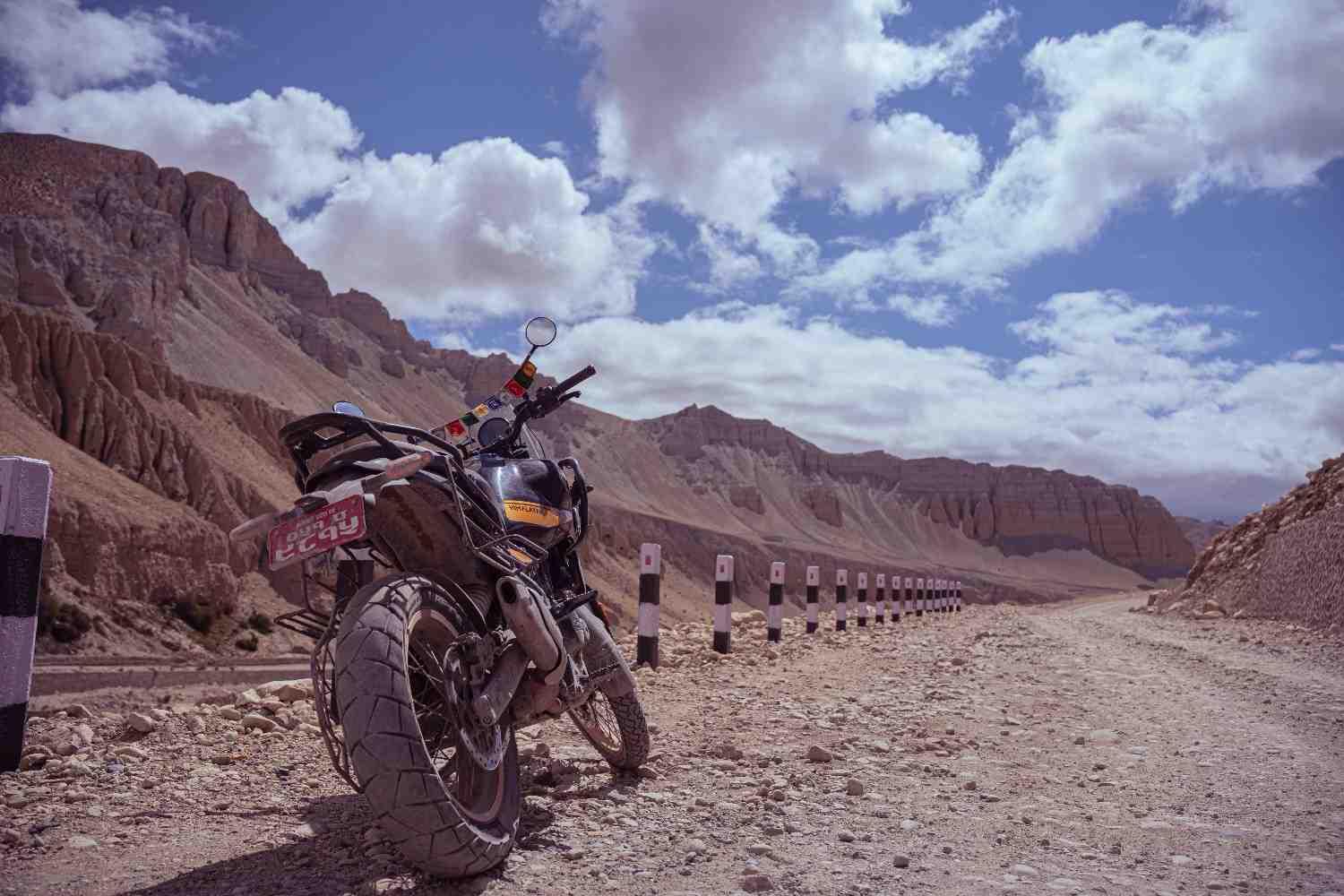
Most riders take two days from Pokhara to Jomsom via Beni and Tatopani, then ride the short stretch to Kagbeni on the morning of day three. The route up the Kali Gandaki gorge is a long ride, and the wind in the afternoon is strong enough to shape the whole day's timing. If you need a bike in Pokhara, the Pokhara rental page lists what is on offer, and the Royal Enfield Himalayan 411 is the usual choice for this route.
The Wind
The Kali Gandaki gorge channels air between Dhaulagiri and the Annapurna range, and the wind builds from mid-morning. By early afternoon it can push a loaded bike across the road. The stretch from Jomsom to Kagbeni runs on open ground, where it hits hardest. Leave Jomsom early and arrive in Kagbeni before the wind peaks.
Road Surface
The road from Jomsom to Kagbeni is mostly sealed, with gravel patches and the occasional washout. Above Kagbeni the surface changes. The track north follows the riverbed and crosses loose gravel, rock, and fords. It is rideable on a capable dual-sport, but it needs attention and some off-road experience.
Where to Stay and Eat
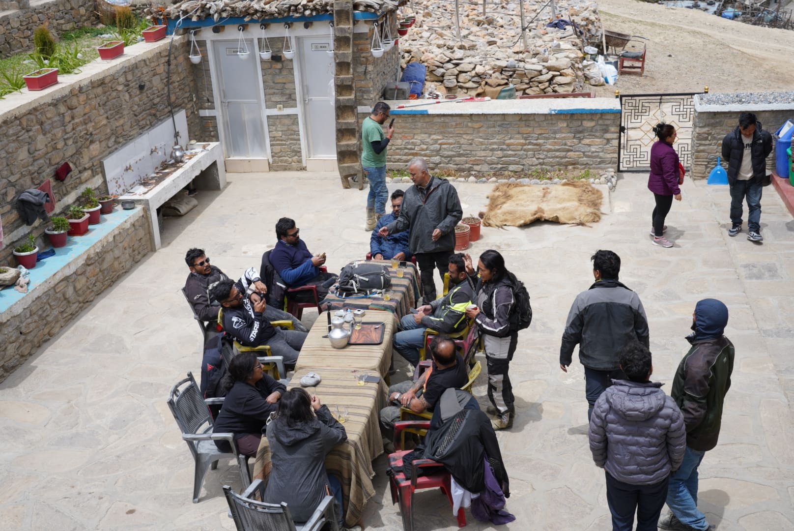
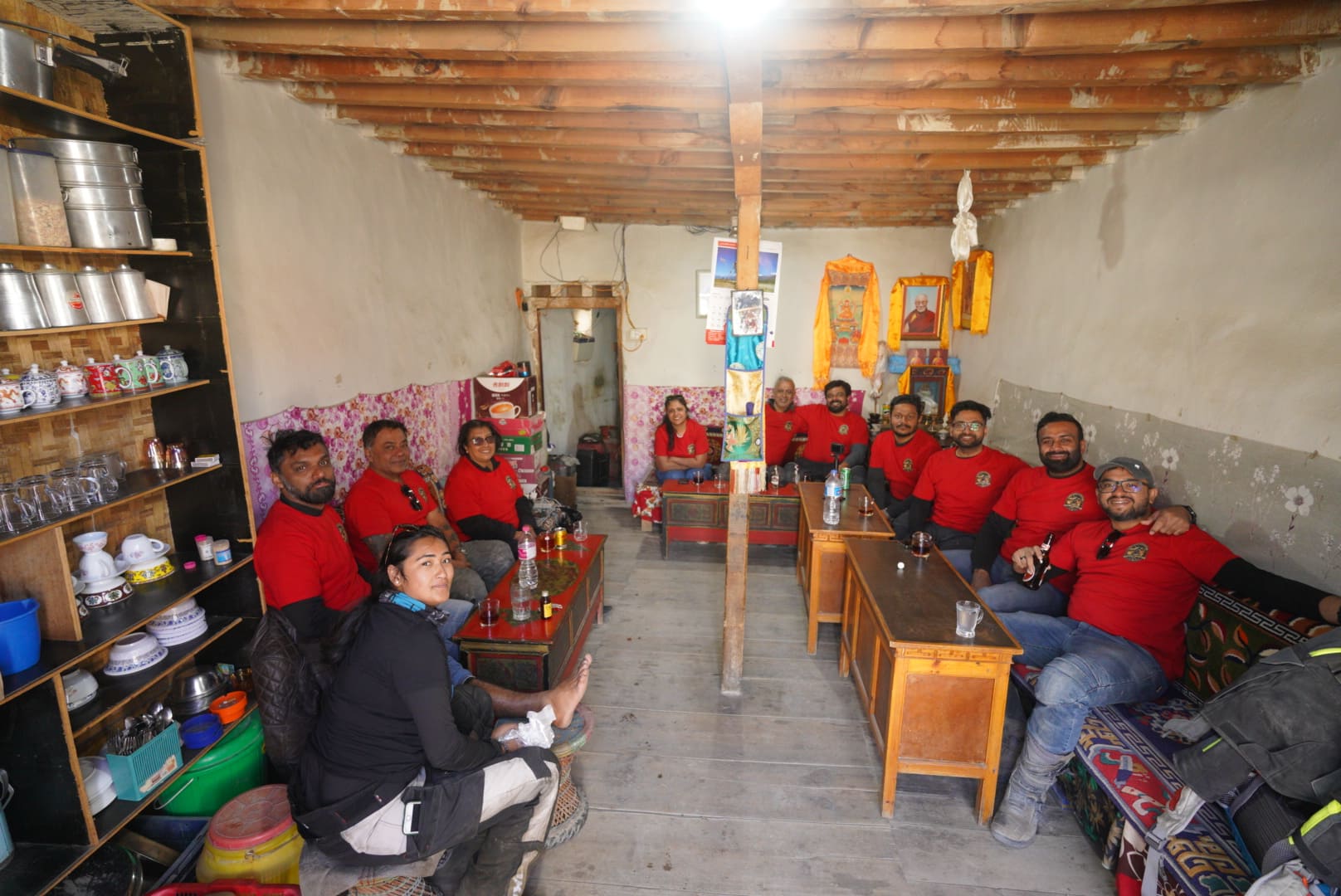
Kagbeni has a small number of lodges and guesthouses, most of them family-run. Rooms are simple, with shared or basic attached bathrooms, thick blankets, and hot water that depends on solar heating or electricity. Rooms in October and May fill ahead of time, so book in advance through your operator or by phone.
Food is plain and filling. Expect dal bhat, noodle soup, Tibetan bread, and apple dishes. Most lodges serve everything in a common dining room warmed by a stove in the evening. Carry water purification tablets or a filter. Electricity can be intermittent, so charge devices when power is available.
Cash is the only payment method. There is no ATM north of Jomsom, and few places accept cards. Withdraw money before you leave Pokhara and carry small notes.
One Night or Two
Stay one night before the checkpoint if you are heading into Upper Mustang. Arriving in Kagbeni the evening before gives you an early start at the checkpoint and a first morning in the village, with the light on the cliffs, before the wind rises.
Stay a night on the way back if you have time. After days in the restricted area, a night in a village with green fields and running water feels like a return to a gentler landscape.
Use Kagbeni as a base for Muktinath. The road to the temple is a day trip from Kagbeni. Read the Muktinath temple guide for what to see, or look at the Jomsom Muktinath Motorbike Tour, a seven-day ride from Kathmandu that ends at the temple.
When to Go
October and May are the busiest months. October has the clearest skies after the monsoon, and May has the pre-monsoon conditions and the Tiji festival in Lo Manthang for riders going north. Spring and autumn temperatures are cool, and the mornings are cold at this altitude. Winter brings real cold and occasional snow, and some lodges close. The monsoon months of June to September bring less rain to Kagbeni than to the rest of Nepal, because the Annapurna and Dhaulagiri ranges block much of it, but road conditions on the approach vary.
The when to visit page on the Nepal Moto Tours site has more on seasons, and the post on combining Manang and Mustang covers timing for longer circuits.
What Riders Say
Rider reviews often mention Kagbeni as the point where the trip changes character. Dan Lawson, who rode Upper Mustang with Nepal Moto Tours, wrote about the hospitality along the route in his rider story, and the full set of rider stories and reviews shows how other riders describe the trip. For a visual sense of the landscape beyond the village, see the post on places in Nepal that look like another planet.
Practical Notes
Fuel: Fill up in Jomsom. Do not count on fuel in Kagbeni or on the track north.
Cold: Mornings and evenings are cold even in the main seasons. Pack a warm layer, gloves, and a windproof shell.
Altitude: At about 2,800 metres, most riders feel little. The effects build over the days that follow, so rest time matters before the plateau climb.
Respect: Dress modestly, ask before photographing people, and walk clockwise around prayer wheels and chortens.
Frequently Asked Questions
Do I need a permit to visit Kagbeni?
You need the ACAP, and the TIMS card may be required depending on your route. You do not need the Restricted Area Permit for Kagbeni itself.
Can I ride past Kagbeni without a guide?
No. Beyond the checkpoint, a licensed guide and a Restricted Area Permit are both required.
How far is Kagbeni from Jomsom?
About 10 kilometres, under an hour by motorcycle.
How far is Kagbeni from Muktinath?
About 10 to 12 kilometres by road, with a climb of roughly 900 metres.
Is there an ATM or fuel in Kagbeni?
No. Take cash and fuel from Jomsom.
Planning to ride through Kagbeni on the way to Lo Manthang? Nepal Moto Tours handles the permits, guide, and support, so the checkpoint is a formality. Get in touch with your dates and riding experience, or browse the Mustang destination page for the full range of routes.