Nepal's geography does something that few countries manage at the same scale: it compresses the full range of the earth's landscape types into a country smaller than most American states. Within a single day's drive from Kathmandu you can move from subtropical jungle to alpine desert, from river valley floor to high Himalayan plateau, through landscape transitions that elsewhere require continental distances to produce.
Some of what Nepal contains does not look like it belongs on this planet at all. The ochre canyon systems of Upper Mustang that look more like the American Southwest than anything the surrounding Himalayas suggest. The high-altitude salt flats that catch morning light in colours that weather reporting does not have names for. The cave cities are carved into cliffs faced by civilisations that archaeology is still working to understand. The glacial lakes that sit in mountain hollows at elevations where the atmosphere is thin enough that the sky above them is a shade of blue that lower altitudes do not produce.
These are fifteen of the best examples. Most are accessible by motorcycle, though some require portions of the journey on foot. All of them are real places in Nepal that look, to most people who encounter them for the first time, like they have been transported from somewhere else entirely.
1. The Mustang Plateau, Upper Mustang
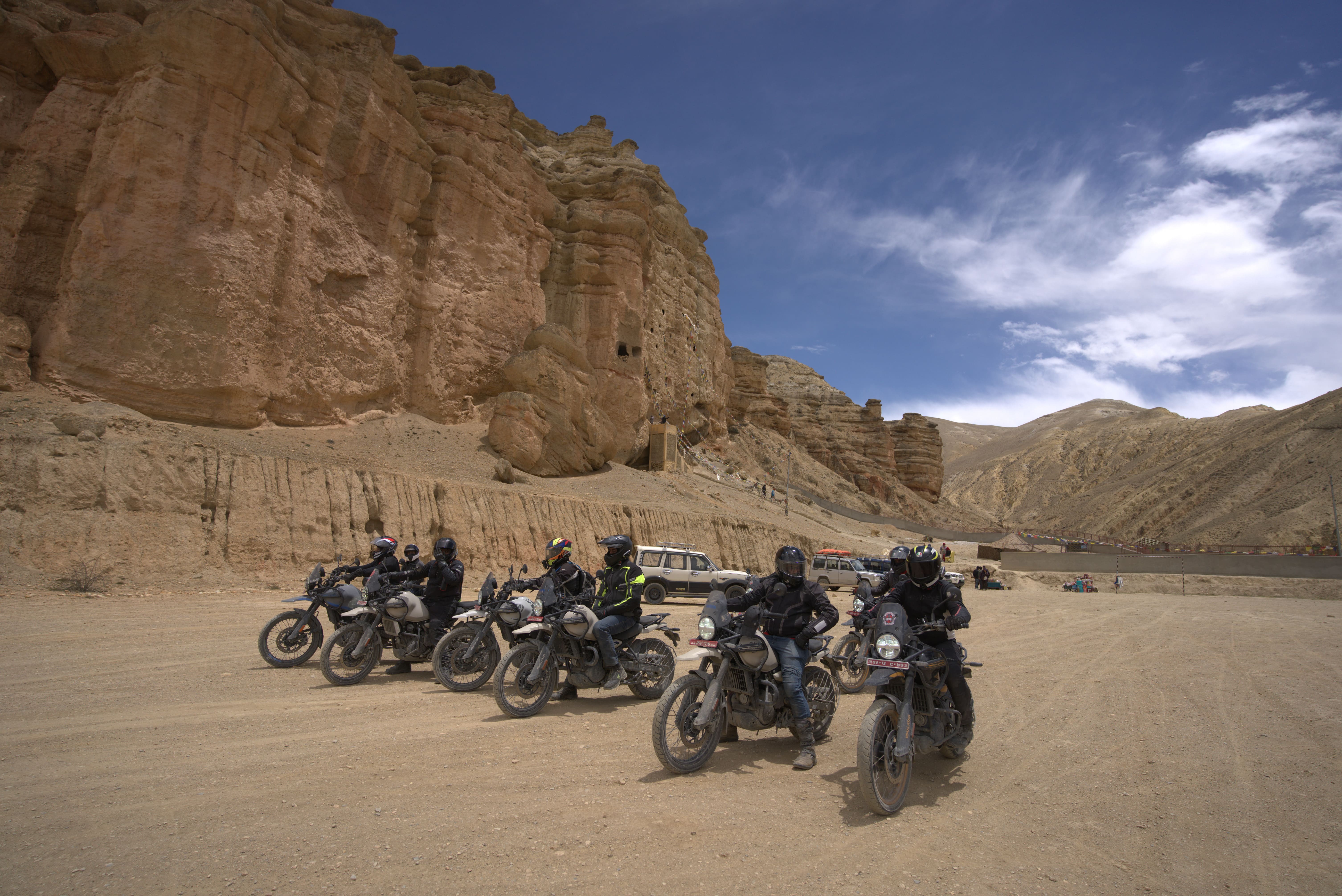
The high desert plateau of Upper Mustang sits north of the Annapurna and Dhaulagiri ranges in the rain shadow that keeps it dry while the rest of Nepal soaks under the Monsoon. The landscape is Tibetan plateau geology wearing Himalayan geography, a combination that produces something visually unlike either: eroded canyon systems in shades of ochre, rust, and cream cut through by river lines that carry snowmelt from peaks visible at the horizon, the whole thing lit from a sky that altitude makes more intensely blue than any sky at lower elevation.
The approach to Lo Manthang across this plateau, particularly in the morning before the Kali Gandaki wind has built to its afternoon intensity, is the kind of riding that changes a person's reference point for what landscape means. The medieval walled city appearing at the plateau's edge looks less like a town than like something archaeology uncovered rather than something people currently inhabit. But people do currently inhabit it, and have for centuries, in buildings that the plateau's dry air has preserved in a state that the lower valley's wetter climate would not have permitted.
By motorcycle: Yes, via Kagbeni. Restricted Area Permit required.
2. Phoksundo Lake, Dolpo
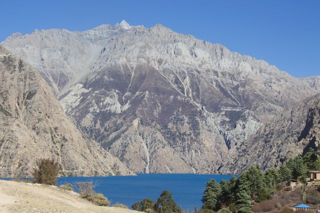
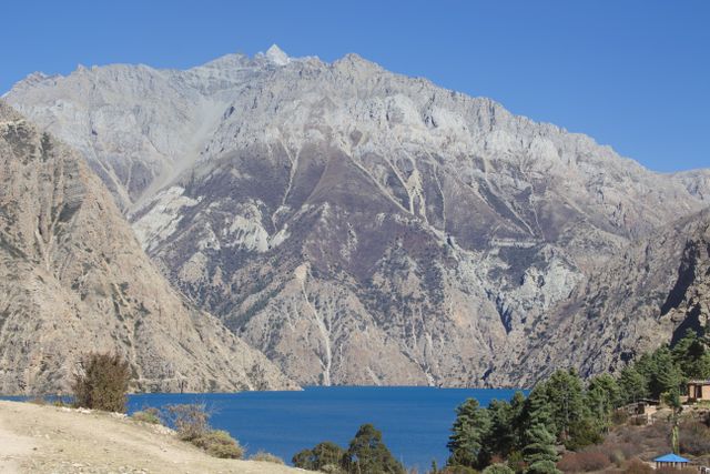
Phoksundo Lake at 3,611 metres in the Shey Phoksundo National Park is Nepal's deepest lake and produces a colour that the word turquoise approaches without capturing. The specific shade, somewhere between the blue of glacial ice and the green of shallow Caribbean water, results from the lake's particular mineral composition and its depth, which prevents the sediment that gives most Himalayan lakes their murkier character.
The lake is surrounded by cliffs of reddish rock that drop directly to the water's edge on the northern and eastern sides, creating a containment that makes the colour more concentrated than an open lake would produce. The effect, particularly in the early morning before wind disturbs the surface, is of a landscape that has been assembled for visual impact rather than geological process.
The approach from Dunai through the Suligad Canyon is itself extraordinary. The canyon walls close to a width that makes the sky a strip above the riding line, and the geological layers in the rock face tell a history of the earth's movement that spans timescales that the human brain accepts intellectually without being able to feel.
By motorcycle: Accessible to the lake's southern edge via the Dolpo approach from Dunai. Upper Dolpo Restricted Area Permit required for the full circuit.
3. The Cave Cities of Mustang
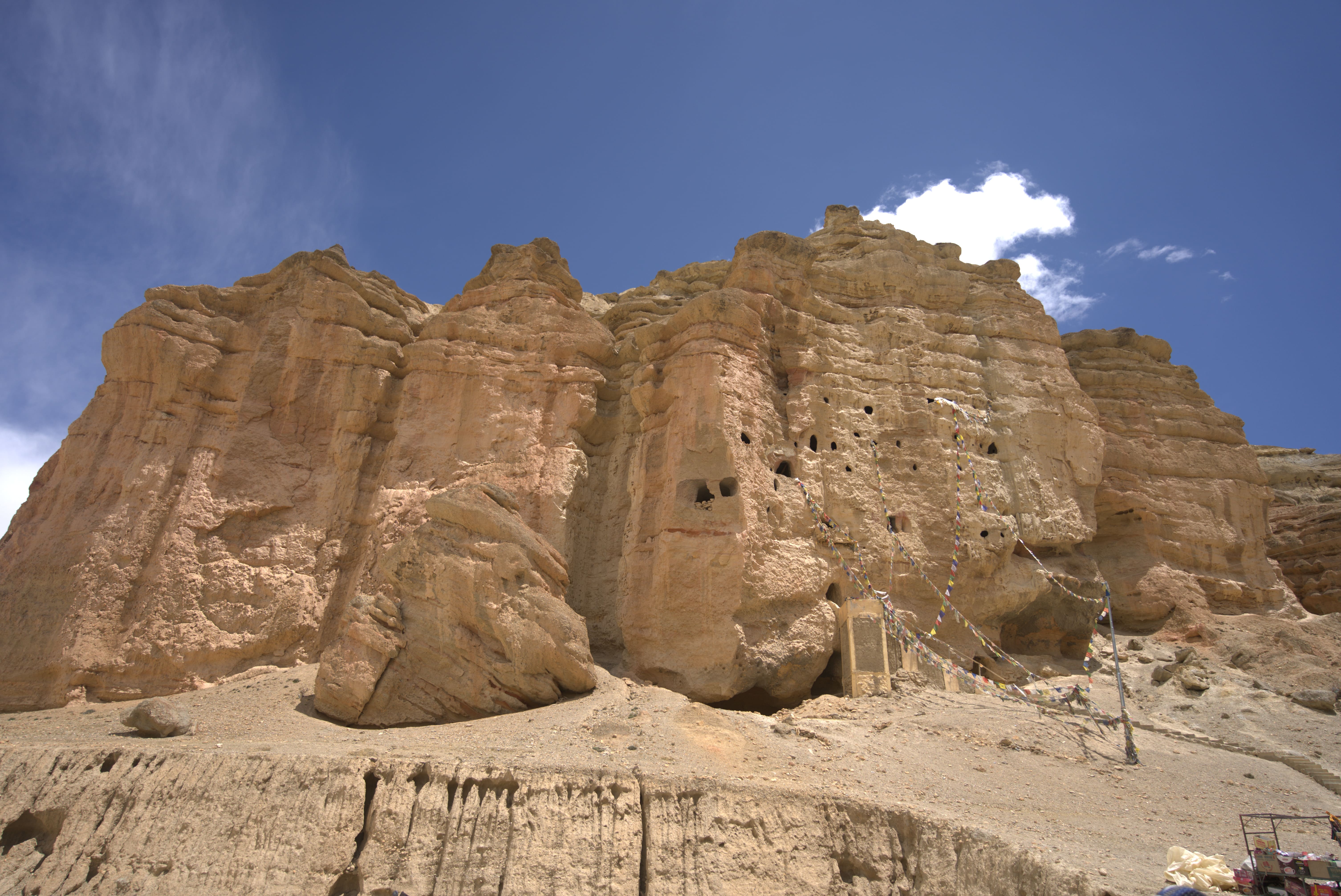
The Himalayan cliffs north of Lo Manthang contain thousands of artificial caves cut into the rock face by a civilisation that predates the Kingdom of Lo by centuries and that archaeology is still working to date and understand. The caves extend across multiple vertical levels of cliff face, some accessible by rope ladder from the level below, some connected by carved passages within the rock, in a configuration that from the valley floor below looks less like human habitation and more like something geological.
Several of the caves contain painted chambers of extraordinary antiquity, their walls covered with Buddhist murals in colours that the dry Mustang air has preserved at a quality that comparable art in wetter climates has not survived to show. The Tashi Kabum caves north of Lo Manthang are among the most significant accessible examples, and the experience of climbing to a cave chamber at 4,000 metres and finding medieval murals on the walls in the same condition their painters left them is not easily compared to anything else Nepal offers.
By motorcycle: Accessible from Lo Manthang by motorcycle to the base, then on foot. Restricted Area Permit required.
4. Rara Lake, Karnali Zone
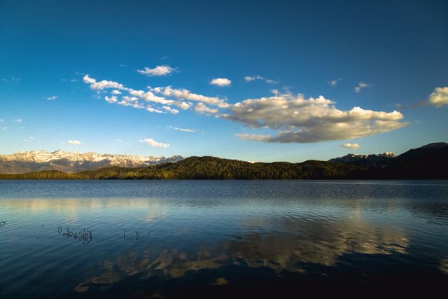
Rara Lake in Nepal's far western Karnali zone changes colour with the light and season in a range that a single photograph cannot represent. In direct morning sun it is cobalt. In the overcast of a high-altitude afternoon it shifts toward pewter. At dusk, when the surrounding sub-alpine forest reflects into the still surface, it takes on colours that the surrounding landscape lends it rather than producing from its own character.
At 2,990 metres, the lake sits in a depression in the Rara National Park landscape that the surrounding ridgelines contain on all sides, creating a stillness that the wind-affected lower altitudes do not produce. The national park around it is one of Nepal's most intact protected environments, with forest cover that the accessible valleys have lost to agricultural use, and wildlife that moves through the landscape with the confidence of places that have not been heavily hunted.
The distance from any road of significance and the difficulty of the approach have preserved Rara in a condition that Nepal's more accessible lakes have not maintained. The reward for managing the approach is a lake in an environment that remains close to what it was before any road reached the Karnali zone.
Rara Lake By motorcycle: Accessible via the Karnali Highway approach from Surkhet, with rough road conditions on the final section.
5. Gosaikunda Lakes, Langtang
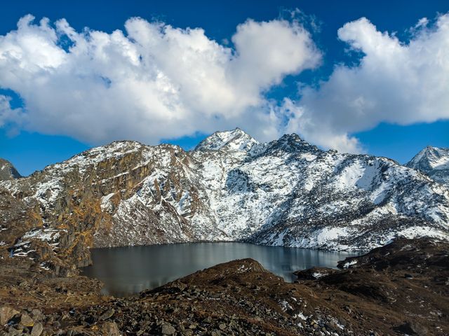
The Gosaikunda lake complex at 4,380 metres in the Langtang National Park sits above the treeline in a landscape of bare rock, glacial debris, and the specific emptiness that altitude produces when it has stripped the terrain of everything except the geological foundation. The lakes, fed by glacial melt from the surrounding ridges, sit in rock basins that the ice carved to shapes that look designed rather than eroded.
The Hindu pilgrimage significance of Gosaikunda adds a human layer to a landscape that its altitude and emptiness would otherwise make feel entirely beyond human context. The Janai Purnima festival in August brings thousands of pilgrims to the lakes by foot, creating a gathering at over 4,000 metres that produces one of the more improbable sights in Nepal: dense crowds in a landscape that its physical character seems designed to exclude all human presence.
By motorcycle: Accessible by motorcycle to Syabrubesi, then on foot. The lake sits above the motorcycle road network.
6. Kagbeni Village
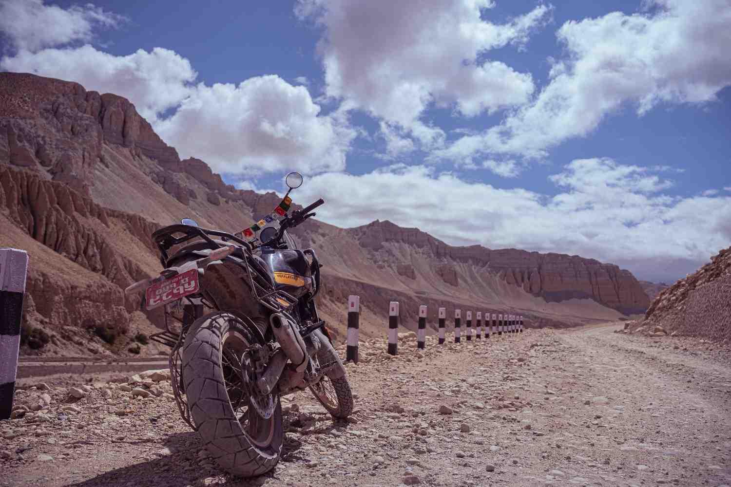
Kagbeni sits at the junction of the Kali Gandaki and the Khong Khola rivers at 2,810 metres, a medieval village of mud-brick houses painted in the ochre and white of Tibetan architectural tradition, watched over by a monastery that fills the entire promontory above the village and that is visible from the road kilometers before arrival.
The combination of the village's architectural character, its position at the literal gateway between the lower valley and the restricted Upper Mustang beyond, and the desert landscape it inhabits produces something that first-time visitors consistently describe as the most surprising landscape encounter of the entire Nepal trip. It does not look like Nepal in any of the ways that photographs of Nepal have prepared most visitors to expect. It looks like a set designer's idea of a Central Asian medieval village rendered in a desert canyon landscape, except that the people going about their lives in it are real and the monastery above them has been continuously inhabited for centuries.
By motorcycle: Direct access via the Jomsom road from Pokhara.
7. Dhorpatan Valley
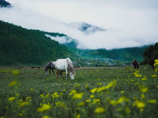
Dhorpatan sits in a broad valley at around 3,000 metres in the Dhaulagiri zone, surrounded by ridgelines that in other parts of Nepal would be dramatic and that serve merely as the container for a valley floor that is one of the largest high-altitude grasslands in Nepal. The scale of the flat area relative to the surrounding mountains creates a proportion that the brain initially misreads, expecting the valley to be smaller relative to the peaks above it than it actually is.
Dhorpatan is Nepal's only hunting reserve, a designation that has kept its wildlife populations at densities that protected parks without hunting permits have not always maintained. The valley floor carries a sub-alpine grassland character that in certain weather conditions, particularly when low cloud sits on the ridgelines and the valley floor is in clear light below it, produces a visual atmosphere with nothing specifically Himalayan about it.
The approach from Baglung via Burtibang is a significant riding day on rough roads that test both the motorcycle and the rider, and the valley's relative inaccessibility has preserved its character in a way that more accessible grassland areas have not.
By motorcycle: Accessible via Baglung and Burtibang. Road quality requires a capable dual-sport machine.
8. Muktinath Temple Surroundings
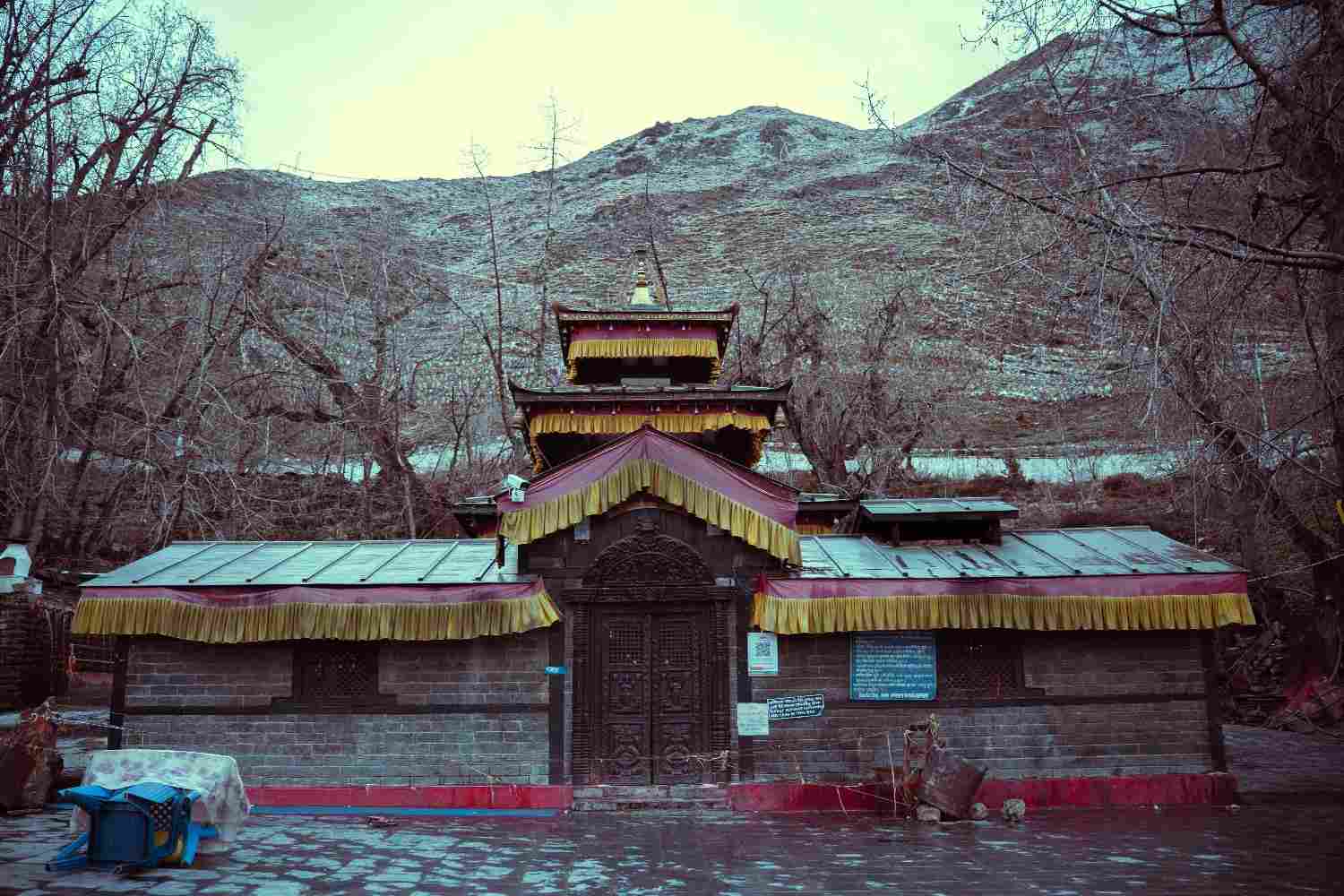
Muktinath at 3,710 metres is one of the most important pilgrimage sites in both the Hindu and Tibetan Buddhist traditions, and the religious significance brings visitors by jeep from Jomsom who might not otherwise encounter the landscape surrounding it. That landscape, a high-altitude desert plateau with the Thorong La pass visible above and the Nilgiri and Dhaulagiri ranges framing the horizon, is the part that the pilgrimage photographs rarely show.
The natural gas flame that burns at the Jwala Mai temple within the Muktinath complex, blue gas flame emerging from rock face beneath a water source in a configuration that defies the intuitive separation between fire and water, is what gives Muktinath its sacred character in both religious traditions. It is also, for a rider arriving at 3,710 metres after the Jomsom approach, one of the stranger things that Nepal produces when it is trying to look ordinary.
Muktinath By motorcycle: Direct motorcycle access from Jomsom on a rough but rideable track.
9. Thorong La Pass Environment
The environment immediately around Thorong La at 5,416 metres, the highest point of the Annapurna Circuit trekking route, sits above the zone where most plant life operates. The terrain on both sides of the pass is bare rock, glacial debris, and the specific flatness of exhaustion that altitude imposes on landscape that would otherwise be dramatic.
Motorcycle access to Thorong La itself is not possible. The pass is a trekking route rather than a road crossing. But the environment of the high approaches, accessible by motorcycle from both the Manang side to around 4,200 metres and from the Muktinath side to similar elevations, gives a rider enough of the pass environment to understand why the people who walk across it describe the experience in terms that most landscape encounters do not generate.
The altitude removes colour from the sky in the way that photographs taken at sea level do not prepare you for. Above 4,000 metres, the blue is a specific and more saturated shade that the atmosphere's reduced depth produces, and the contrast with the white and grey of the rock and snow terrain below it is sharper than any landscape at lower elevation.
By motorcycle: Accessible to the high approaches from both Manang and Muktinath sides.
10. Tilicho Lake
Tilicho Lake at 4,919 metres is the highest lake of its size in the world, a fact that its visual character justifies rather than merely claims. The lake sits in a glacial bowl with the Tilicho Peak above it and the rock walls of the Annapurna massif forming the lake's northern boundary, a containment that makes the water's surface appear to belong to a different atmosphere from the one the surrounding terrain inhabits.
The approach from Manang is a trekking route rather than a motorcycle track for the lake itself, but the Manang approach by motorcycle to the base of the trail is part of the Annapurna Circuit that gives motorcycle access to the beginning of the high-altitude environment that Tilicho exemplifies. Riders who make the ascent on foot from where the motorcycle road ends find a lake that the trekking literature calls the world's highest of its type and that visual experience confirms requires no qualification.
By motorcycle: Accessible by motorcycle to Manang, then on foot to the lake.
11. Suligad Canyon, Dolpo
The Suligad Canyon on the approach to Phoksundo Lake in Dolpo is the kind of geological feature that looks like it should be famous and is not, primarily because of the difficulty of reaching it. The canyon walls close to a width that the motorcycle track fills almost completely, with rock faces rising on both sides to heights that vary between dramatic and vertiginous depending on the section.
The rock layers in the Suligad walls represent geological time in a way that landscape usually conceals. Different strata at different elevations record different periods of the earth's history in colours and textures that the canyon's narrowness and the wall's height make visible in cross-section the way a scientific diagram makes a geological column visible on paper.
The motorcycle track through the canyon is narrow, rough, and occasionally spectacular in the most literal sense of the word. It is the approach to Phoksundo Lake that most riders describe as more striking than the lake itself, which is some claim.
By motorcycle: Part of the Dolpo approach route from Dunai.
12. The Annapurna Sanctuary Approach
The Annapurna Sanctuary, the high glacial basin enclosed within the Annapurna massif at around 4,100 metres, is accessible by trekking rather than motorcycle, but the lower sections of the Modi Khola valley that lead to it are accessible from the Pokhara side by motorcycle to the trailhead villages. The landscape of the Modi Khola gorge, the valley that provides the only entrance to the Sanctuary, has a specific character that the enclosed high-altitude basin above produces by requiring the gorge to be narrow enough to be defended by the topography on both sides.
The views of the Annapurna South and Machapuchare faces from the trekking sections above the motorcycle road are among the most photographed in Nepal, and the reason is that the scale relationship between the viewer and the mountain at close approach is different from any view of the same peaks from the Pokhara lakeside or the lower valley. The mountains do not look bigger in the conventional sense. They look present in a way that distance prevents.
By motorcycle: Accessible to the lower Modi Khola valley trailheads from Pokhara.
13. Lukla and the Khumbu Approach
The Khumbu valley above Lukla, the approach to Everest Base Camp, is not accessible by motorcycle road. The motorcycle interest in this part of Nepal is the road from Kathmandu toward the Solu Khumbu region, which reaches the lower approaches and provides a riding experience that the helicopter and flight access most Everest-bound travellers use removes entirely from the journey.
The landscape character of the Solu Khumbu in the lower sections, the Sherpa cultural villages with their distinctive stone architecture, mani walls, and chorten gateways, and the visual approach to the high Khumbu peaks from lower elevations that the road provides before the trekking route takes over, is underexperienced by motorcycle riders who associate Everest Base Camp with aviation access rather than ground-level approach.
The road from Kathmandu to the lower Khumbu approaches passes through the Solu region, a Sherpa cultural landscape that the trekking tourism of the upper Khumbu has transformed at altitude but that the lower valley retains in a character closer to what pre-tourism Sherpa culture produced.
By motorcycle: Accessible by road to the lower Solu Khumbu approaches before the trekking route begins.
14. Namche Bazaar and the Upper Khumbu
Namche Bazaar at 3,440 metres is not an undiscovered destination. It is one of the more visited places in Nepal and the commercial hub of the Everest trekking industry. What makes it appear on this list is not its obscurity but its visual character, which the photographs and the reputation do not accurately represent.
The town is built into a natural amphitheater of hillside at a point where the Bhote Koshi and the Dudh Koshi rivers meet below, with the ridgelines above it framing a specific view of Everest and Lhotse that appears only from the particular position the town occupies. This view, the first appearance of Everest for trekkers coming from Lukla, produces the kind of sudden visual recalibration that landscape occasionally generates and that no amount of prior looking at photographs adequately prepares a viewer for.
The town itself, rebuilt and expanded from a small trading village into a trekking hub over the past four decades, has a layered character. The traditional Sherpa stone architecture exists alongside the lodges, bakeries, and gear shops that the trekking economy has added, and the combination is specific to this altitude, this culture, and this particular intersection of traditional and tourism economies that no other place in Nepal quite replicates.
By motorcycle: Accessible to the lower Khumbu by road; Namche itself requires trekking access.
15. Halji and the Limi Valley, Humla
The Limi Valley in the Humla district of far western Nepal borders Tibet and China on two sides, sits at elevations between 3,900 and 4,500 metres, and is accessible only via a journey from Simikot that involves several days of trail travel beyond where any motorcycle road currently reaches. It belongs on this list despite that access difficulty because the landscape it contains, and the cultural settlement at Halji village within it, are in the category of places that exist as they do specifically because they have been too remote to be reached by the forces that change such places.
Halji is a Tibetan Buddhist village that maintains a practice tradition and a community structure that its isolation has preserved in conditions that more accessible Tibetan Buddhist communities have not maintained. The Rinchenling Monastery at Halji, founded in the eleventh century and damaged by flooding in 2022 with subsequent international attention to its restoration, is one of the oldest active monasteries in Nepal.
The landscape of the Limi Valley itself, high-altitude grassland rimmed by peaks and plateaus that extend into Tibet, produces the specific visual character of the high Himalayan rain shadow: clear, dry, vast, and coloured in the ochre and grey of rock and thin soil that the altitude's cold and dryness allows only the most adapted plants to cover.
By motorcycle: Accessible by motorcycle to Simikot; the Limi Valley requires trail access beyond the current road network.
Getting to These Places
The majority of destinations on this list are accessible by motorcycle, either directly by road or to a close approach from which the final section is on foot. Nepal's motorcycle touring infrastructure, centred on the Royal Enfield Himalayan and the network of mechanics and tea houses that the country's serious riding culture has built, supports access to most of them with appropriate planning.
The restricted area destinations, Upper Mustang for the plateau and cave cities, Dolpo for Phoksundo Lake and the Suligad Canyon, Humla and Limi for the far western routes, require permit processing through registered Nepal Tourism Board operators. Rara Lake requires the Rara National Park permit and the logistical management of the Karnali Highway approach. The trekking-access destinations, Gosaikunda, Tilicho, the Annapurna Sanctuary, and the upper Khumbu, are accessible by motorcycle to the trailhead and then on foot.
The common requirement across all of them is a motorcycle capable of Nepal's mountain roads and a rider prepared for the conditions those roads produce. Nepal does not require expert-level riding ability for most of its extraordinary destinations. It requires honest self-assessment of skill, appropriate equipment, and the willingness to plan further in advance than the more accessible destinations demand.
What it returns for that preparation is landscape that has no equivalent in most riders' experience, in a country small enough to contain it all within a single serious trip.